New Zealand and Australia (Part 2) - first a little preamble to New Zealand
My blog is now going a little out of chronological travel order. After we left Tonga, we went back to Cairns, AUS, then to Townsville, then to Sydney, and then on to New Zealand. I'll tell you more about those ports in the second part of this blog. For now I'll chronicle our trip to New Zealand.
This was Kathie's and my second visit to New Zealand. Mine was 12 years ago, and Kathie’s was 30 years ago. As it turns out, it was a good-news, bad-news visit. The good news was that we had already enjoyed some of the incredible scenery from our previous visit. The bad news was that our ship’s itinerary was so drastically changed it prevented us from repeating some of what we had seen before. That said, we did have a great time in New Zealand, primarily because my son Jason and his wife Heather flew in and met us at our first port of Tauranga. But before I get into the details of the trip let me provide some background information on the country of New Zealand.
New Zealand
New Zealand is a remote island nation in the southwestern Pacific Ocean, known for dramatic landscapes, a strong indigenous culture, and a modern, stable economy. It consists mainly of two large islands—the North Island and South Island—along with hundreds of smaller islands. The country sits on the boundary of the Pacific and Australian tectonic plates, making it geologically active with earthquakes and volcanic activity. It has a total population of approximately 5 million, with primary heritage of European, Māori (original settlers in the 13th century), Pacific Islander, and Asian communities.
Tauranga - our first port of call
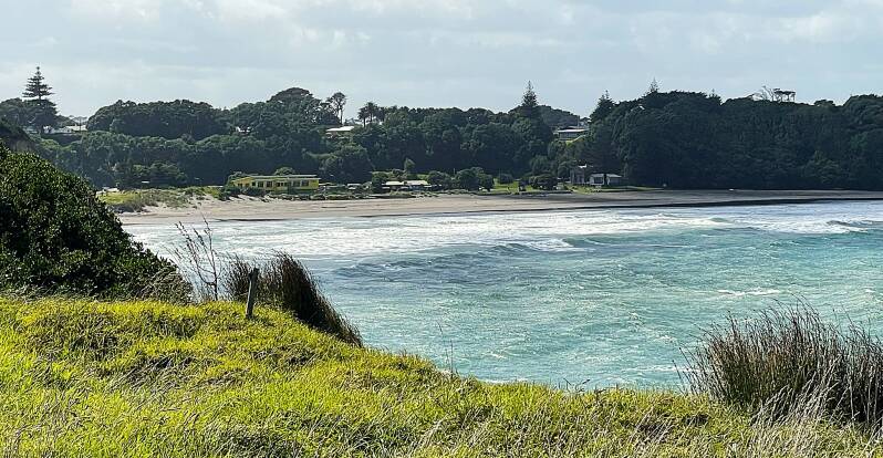
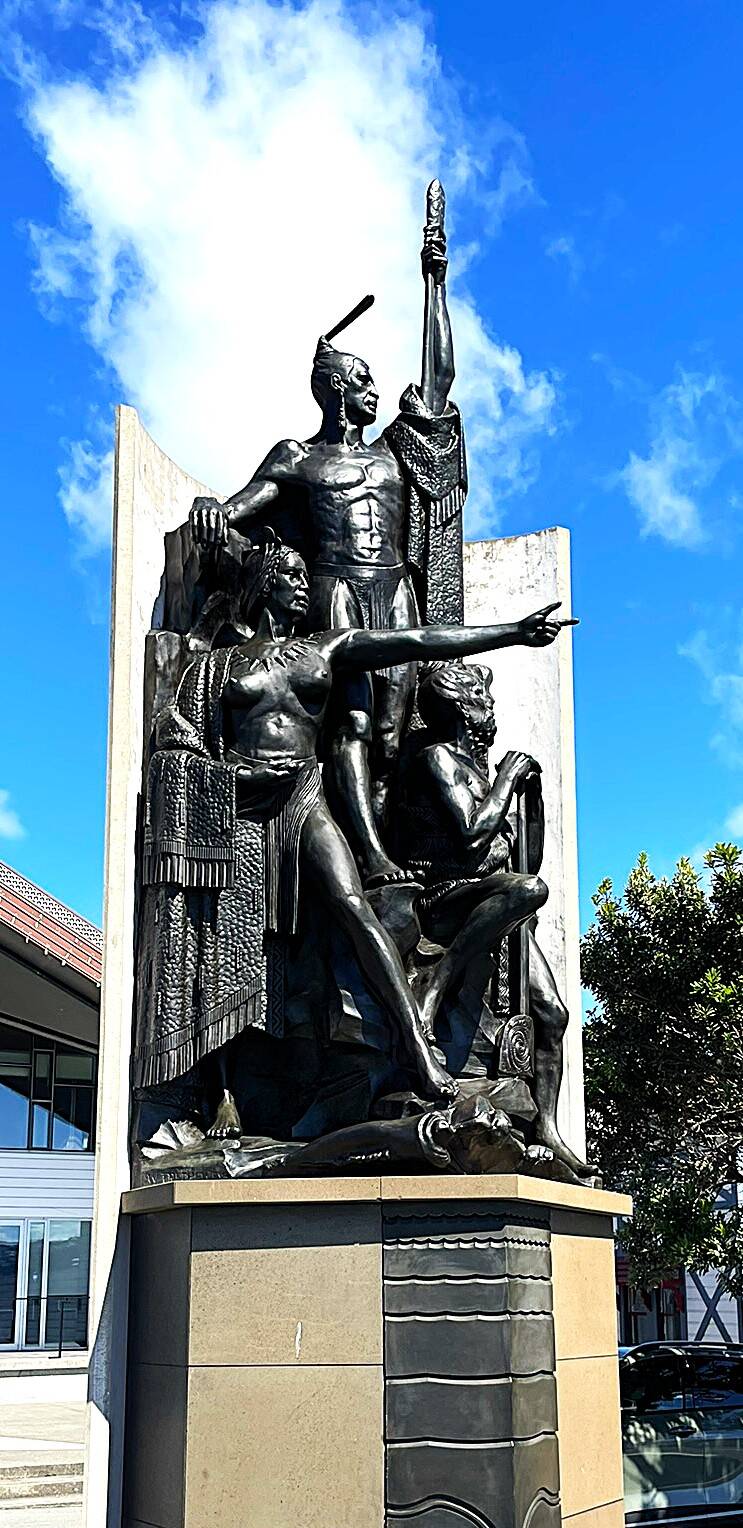
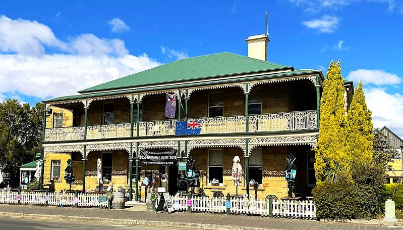
Tauranga sits on a natural harbor facing the Pacific Ocean and is about a 2.5–3 hour drive southeast of Auckland. The city blends waterfront living with easy access to beaches, farmland, and inland geothermal regions. Because of the aforementioned changes to our itinerary, instead of Jason and Heather boarding the ship and settling in, they boarded as just visitors because the ship was scheduled to leave that evening, after only being in port for less than a day. So we gave Jason and Heather a quick tour of the ship, then our cabin, then a nice lunch. Because of the itinerary change, Kathie and I packed our bags and headed off the ship with Jason and Heather for our next 6-day journey inland. Since we only had a few more hours of daylight, we did a quick tour of the waterfront area, where we found an interesting sculpture that exemplifies the expression "fighting like dogs and cats".


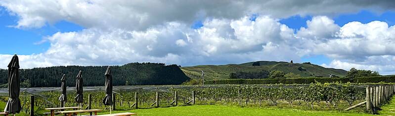
We all stayed in a little motel that night, not far from the ship, then we began a six-day, 2100-mile tour of the North Island. Not far outside of Tauranga is the little town Te Puke. I'm sure most of you know this, but Te Puke is the kiwifruit capital of the world. New Zealand produces billions of kiwifruit annually. There are two types of kiwifruit – green and gold. Gold kiwifruit was developed in New Zealand through selective breeding. The fruit is picked firm and ripens after harvest. Grown on woody vines supported by trellis systems and covered by netting to protect the fruit from insects and birds. Kiwifruit vines can live for decades. Here are a few pictures from the many kiwifruit orchards that we passed. Our next stop was the coastal city of Napier.


Napier
Napier is a coastal city on the east coast of New Zealand’s North Island, with a population of around 70,000. It is best known for its remarkable concentration of 1930s Art Deco buildings, rebuilt after the devastating 1931 Hawke’s Bay earthquake. Because so much of the city was reconstructed at once, Napier is often considered one of the best-preserved Art Deco cities in the world. Additionally, it has a wonderful waterfront park next to a fine pebble black beach. Here are some pictures of the Art Deco building and the waterfront park.


After our tour of Napier, we were back in the car for our next stop the Rotorua area.
Rotorua is one of New Zealand's most unique destinations - famous for its geothermal activity and Maori culture.
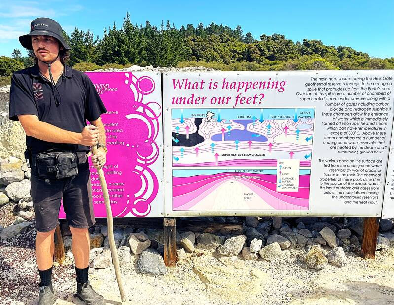
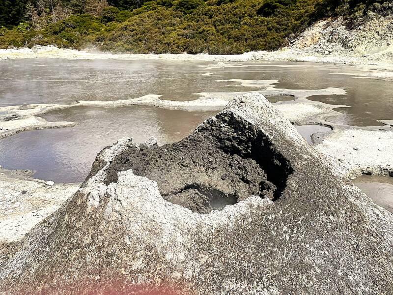
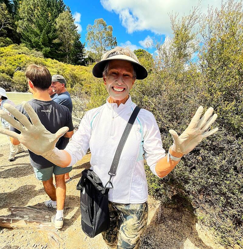
There are a number of geothermal attractions in this area but we settled on a guided tour through Hell's Gate. Hell's Gate Geothermal Reserve and Mud Spa is one of the most dramatic geothermal attractions in the Rotorua area, located about 15 minutes east of central Rotorua at Tikitere. It is the most active geothermal reserve in New Zealand and combines a geothermal park with mud baths and sulphur spas. It is the only place in New Zealand where you can soak in outdoor geothermal mud baths. Māori have used the mud and mineral waters here for more than 800 years to soothe aching muscles, arthritis, inflammation, and skin conditions. The spa uses three types of mud: Black mud for arthritis and rheumatism; White mud traditionally used for burns; and Grey mud for gentle skin exfoliation. You get one guess as to who got mud all over themselves. Here some pictures from Hell's Gate.


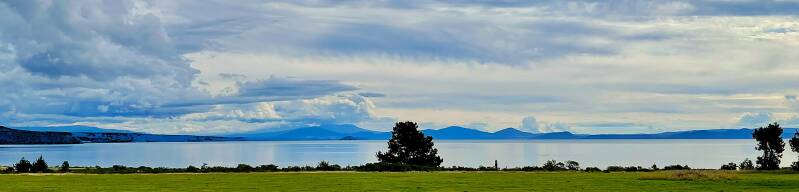
After leaving Hell's Gate, we made a quick picture stop at another historical attraction. Lake Taupō is the largest lake in New Zealand and the biggest freshwater lake in Australasia, occupying a volcanic caldera in the central North Island. Formed by massive eruptions about 27,000 years ago, it anchors the Taupō Volcanic Zone and remains one of the country’s most iconic natural landmarks. The lake fills the caldera created by the Oruanui eruption—the largest known on Earth in the past 70,000 years. You're looking at the rim of the caldera and the lake.
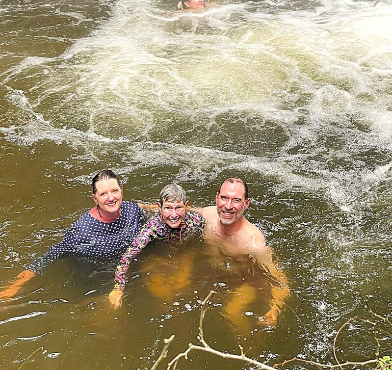
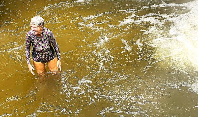
Next up was an opportunity for the kids (that would be Kathie, Jason and Heather) to get a real feel for New Zealand's geothermal activity. So off we went to the Kaingora Forest Hot river. Here's some pictures of the kids frolicking in the hot river...by the way, if you're wondering, someone had to stay on solid ground to take the pictures.
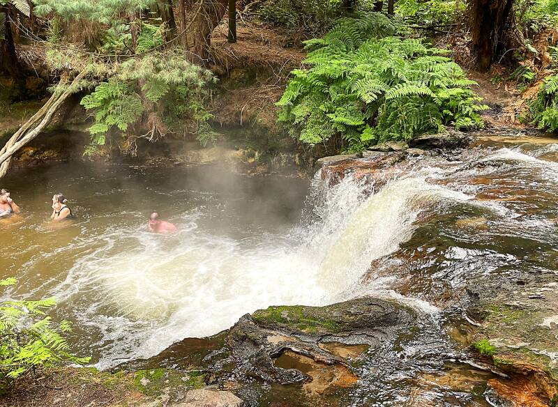


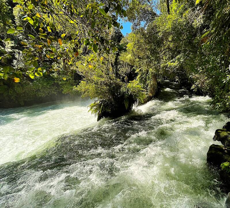
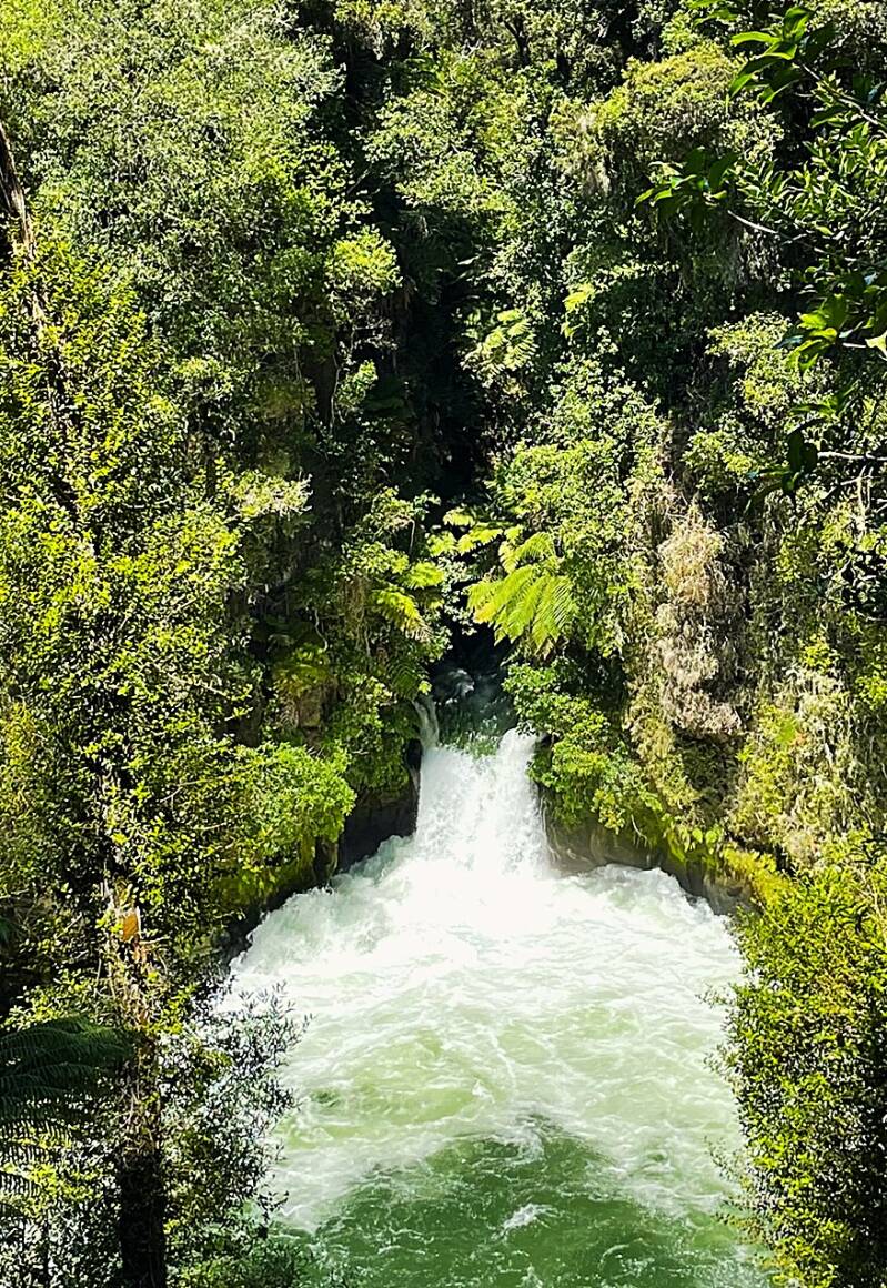
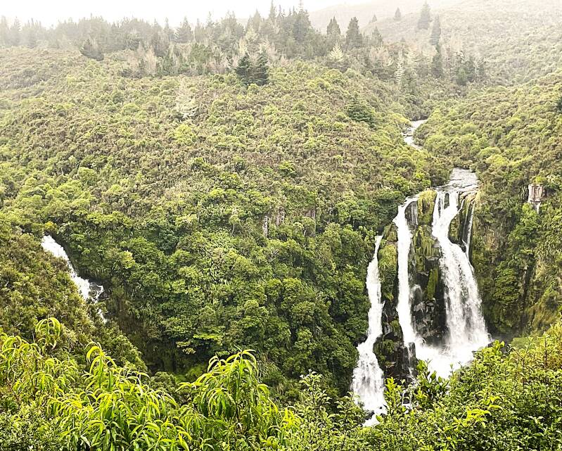
After drying off, it was back on the road to see yet another magnificent New Zealand water attraction. This time it was Huka Falls. A powerful and visually striking waterfall on the Waikato River, located just north of Taupō on New Zealand’s North Island. It is formed where the Waikato River, New Zealand’s longest, narrows abruptly from 300 feet wide to 45 feet as it exits Lake Taupō. This constriction forces immense water pressure through a volcanic canyon, creating a series of rapids that culminate in a dramatic 20 to 30-foot drop, depending on water volume. It is the world's highest whitewater rafting drop. Our last stop of the day was a panoramic view of the Waipohatu Falls.

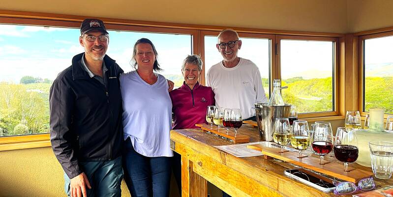
After an exhausting day of sightseeing we had the good fortune of staying at the beautiful Nga Pari vineyard B&B in Masterton wine region. From top to bottom, left to right - front view of the B&B (that windowed room at the top is the wine tasting room), backyard and vineyard at the B&B, wine tasting at the B&B, dinner at the local pub - the Buckhorn Inn.


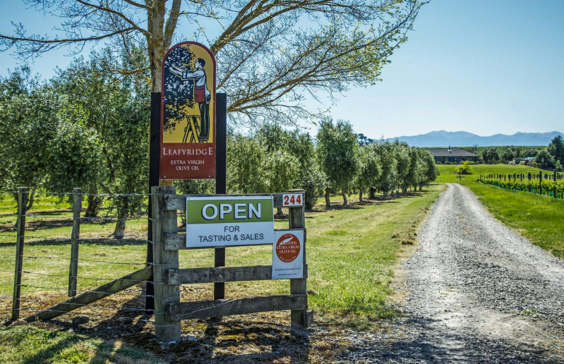
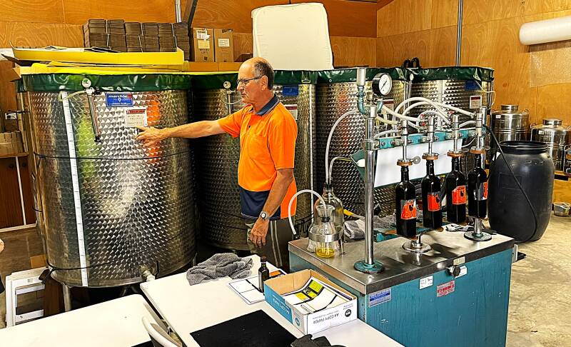
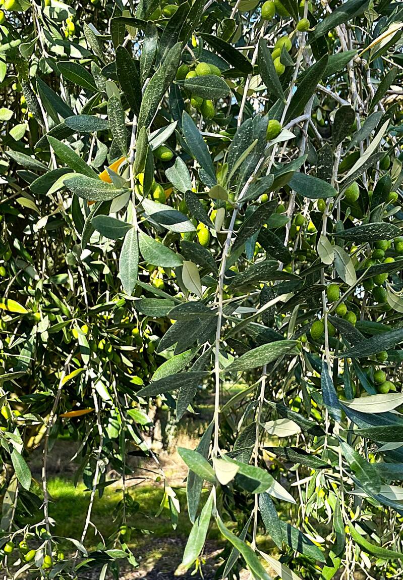
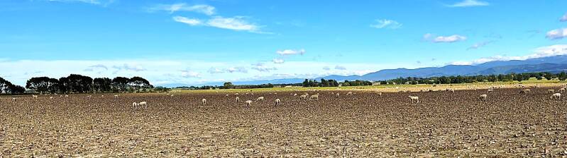
Before we turned in for the night, our B&B hostess arranged for a private tour of a neighboring Olive Oil facility the next day. So we kicked off the next day with a 3-minute drive to Leafy Ridge Extra Virgin Olive Oil farm. The proprietor, Craig, met us as soon as we arrived and spent the next hour giving us the history and current state of the olive oil facility. Craig and family relocated to the land from South Africa in 1999. After digging and planting 4,000 olive trees by hand, they waited until 2005 for their first crop. We learned all about olive trees, olive harvesting, producing extra-virgin olive oil, and the sale and distribution of the finished product. From top to bottom, left to right – entrance to Leafy Ridge with olive trees on the left, Craig with tanks of the finished product, olives on the tree and a display rack of flavored olive oil. As we left Leafy Ridge we passed one of the many sheep grazing fields. Of particular interest, for this field, was the fact that it was full of turnips that the sheep were munching on.

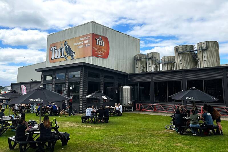
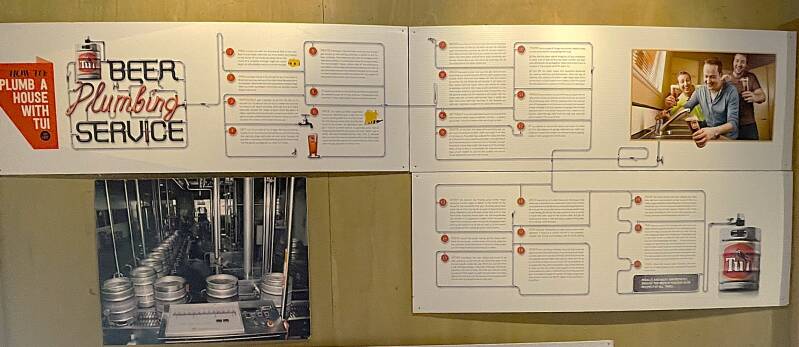
Well, as we continue with our travels, we've been to vineyards and wine tastings; olive trees and extra-virgin olive oil tastings; so it was time to move on to hops and beer tastings. Our next stop was the Tui Brewery in Mangatainoka. Tui Brewery has been around in one form or another since Henry Wagstaff first set up shop on the banks of the Mangatainoka River in 1889. We stopped for lunch and, of course, beer tasting. Here's a picture of the brewery and one for the real beer lovers who want to plumb their house to serve beer from every faucet:-)
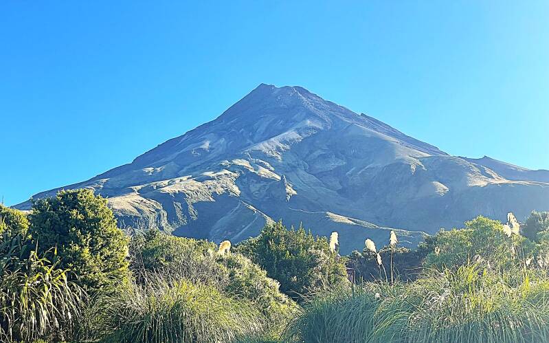
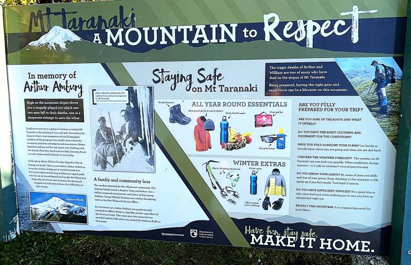
After lunch our journey continued heading northwest toward the port city of New Plymouth. New Plymouth is the main city of the Taranaki region on the west coast of New Zealand’s North Island. The surrounding Taranaki region is dominated by Mount Taranaki, an almost perfectly symmetrical volcanic peak that rises to 2,518 m (8,261 ft). The mountain is visible from much of the region and is surrounded by dense forest in a remarkably circular national park boundary. Here's a few pictures from the park.
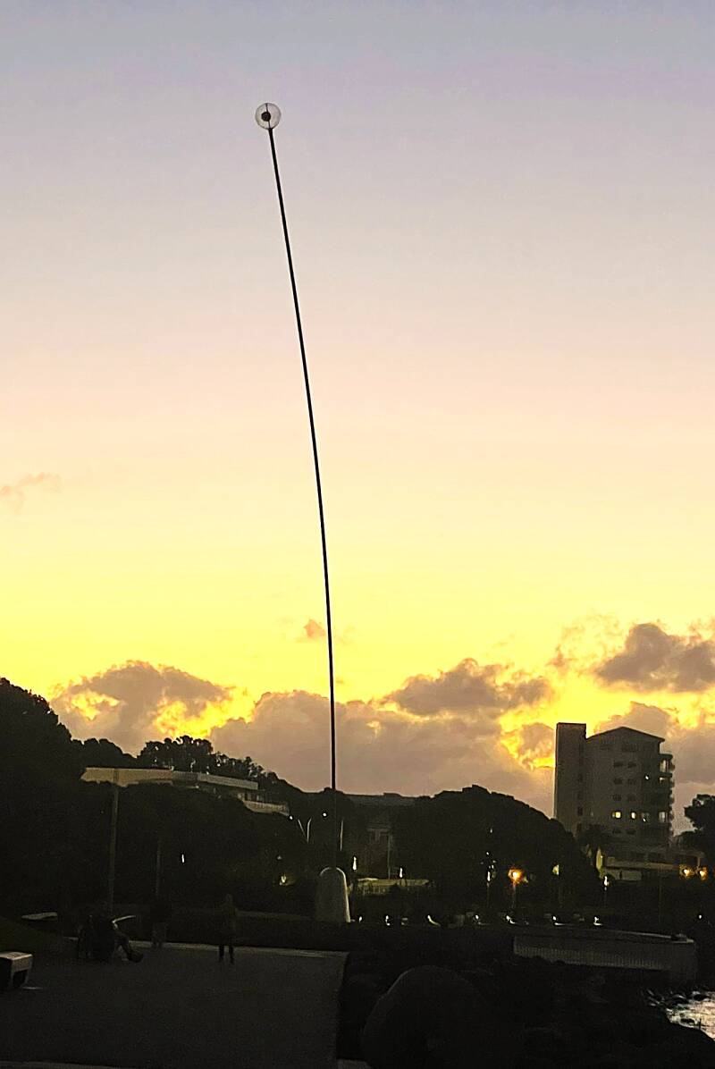
After checking into our New Plymouth B&B, we headed downtown for a delightful dinner at a local craft brew pub. Then, to walk off our dinner, we strolled down to the waterfront for a leisurely walk. One of the highlights of the waterfront is the 13 km coastal path that runs along the ocean, which includes the famous Len Lye Wind Wand sculpture. The Wind Wand is 48 meters (157 feet) tall. Most of it is a slender red fiberglass-and-carbon-fiber pole about 20 cm (8 inches) wide. In calm weather, it stands almost straight, but in strong winds it can bend as much as 20 meters, creating a slow, graceful waving motion. At the very top is a red sphere containing 1,296 LED lights. At night, the sphere glows red, making the sculpture especially striking against the waterfront and ocean. See below.
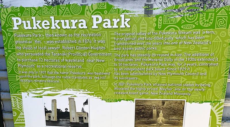
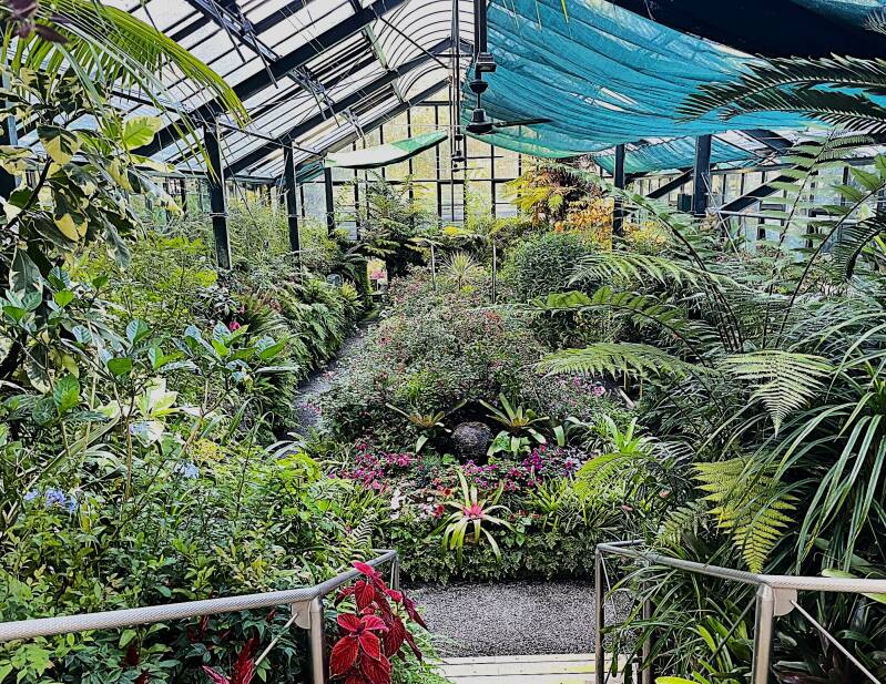
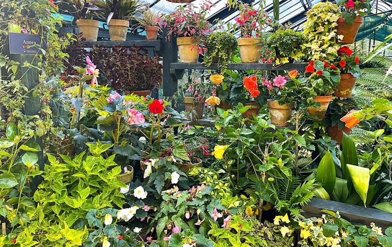
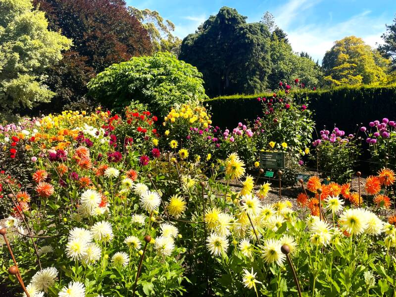
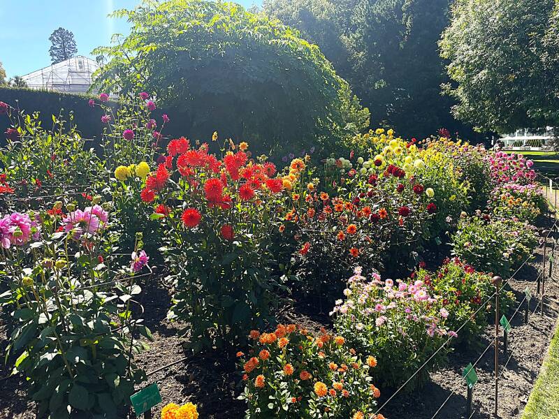
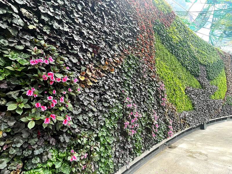
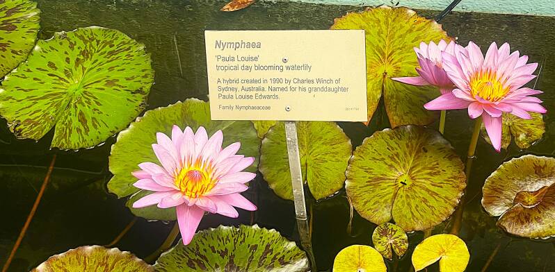
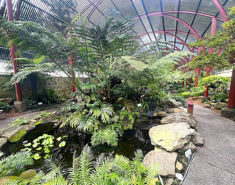
Well, since we were in another city, we of course had to go to, wait for it, another botanical garden. This one was really good. Pukekura Park, a large botanical garden and park right in the center of town, covers more than 50 hectares and includes lakes, walking paths, fern houses, a zoo, and the Bowl of Brooklands outdoor amphitheater. One of the park's more interesting features was the conservatory buildings. There were three large buildings, each with multiple levels, connected by a series of tunnels. So for our many flower loving friends, here's some pictures I hope you'll enjoy.


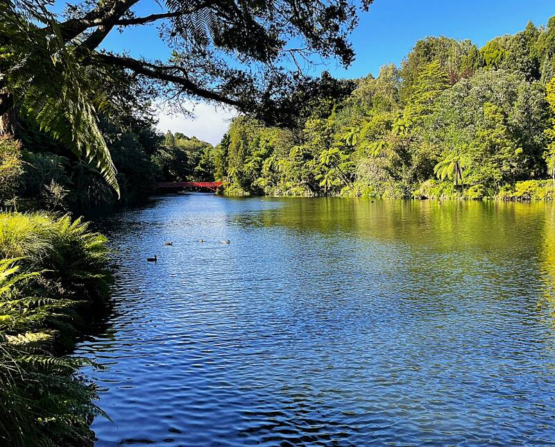
After leaving the conservatory buildings, we wandered the grounds where we came upon a giant sequoia tree, a lake and a waterfall.


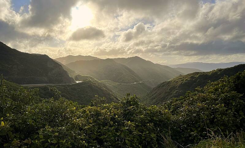
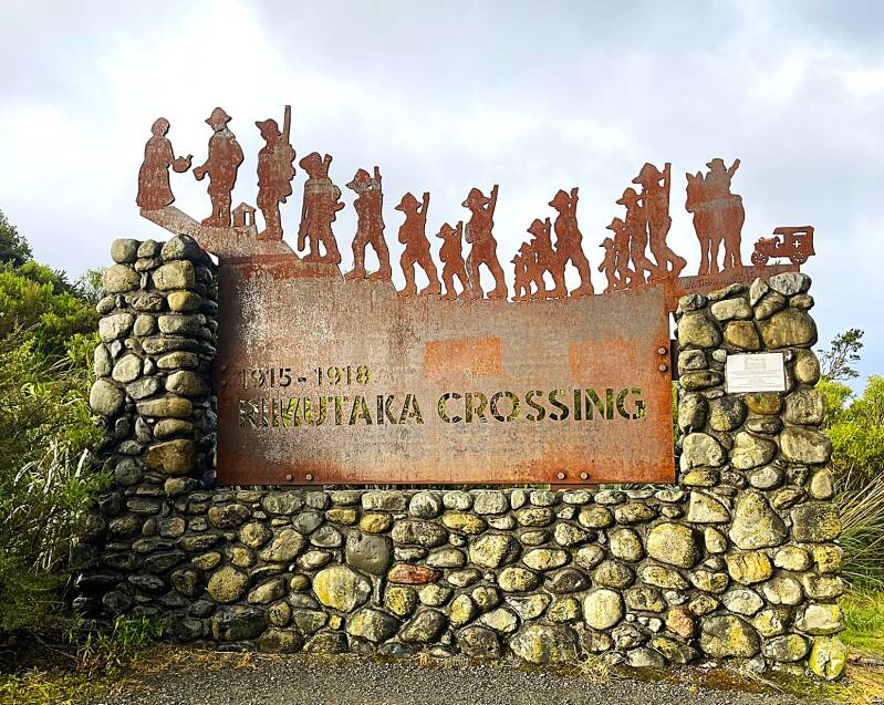
After exiting the park, we had a rather long and interesting drive from New Plymouth along the western coastline, through the Remutaka Crossing mountain pass, and then on to Martinborough, which is in the middle of a significant wine-producing area. Here's a look at the western coast of the North Island, the Remutaka Mountain range, and the range crossing sign (notice the last symbol at the top of the sign - very appropriate for those making the 1700 ft climb).
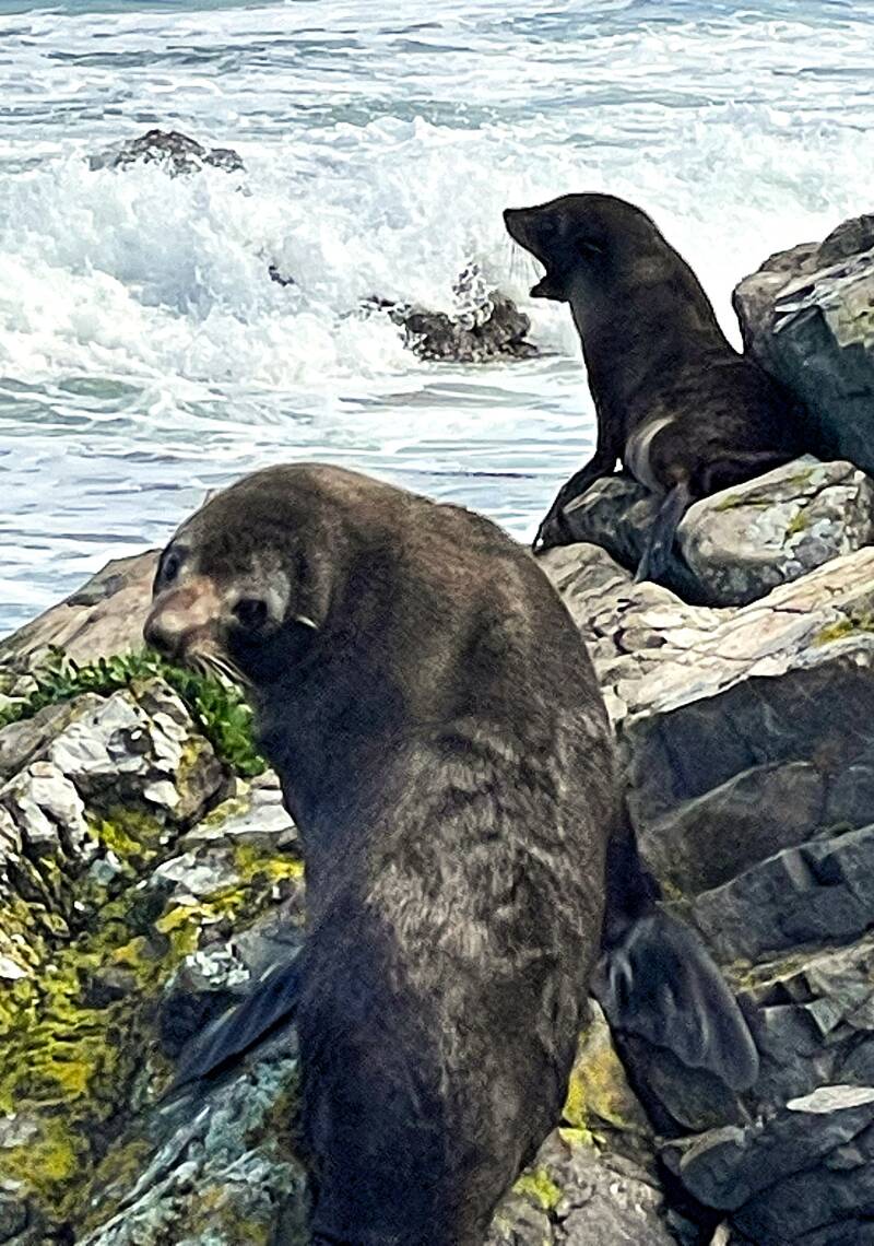
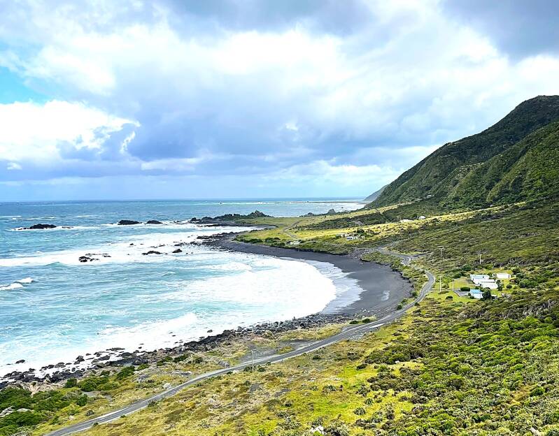
Upon arriving in Martinborough, we had a nice meal at a local pub and then rested for the night at another B&B. The next morning, we headed out on our next adventure, this time in the rain with winds gusting to 40 mph. Our destination was Cape Palliser, which is the very southernmost point on the North Island. Along the way to the Cape, we encountered several seal colonies. Very cute but not too energetic, as you can see from the following pictures. First, a mother and her "baby", then a herd of seals, and lastly two curious seals.


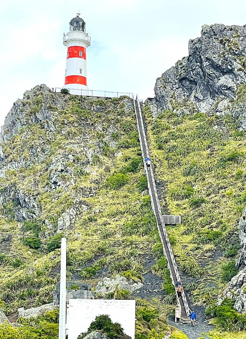
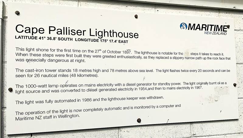
Further down the rocky road, we came to the literal "end of line"...the lighthouse at Cape Palliser. For those of you who are afraid of heights, you should consider skipping this one. For those of you who are thrill-seeking and adventurous, there are 253 steps to make your day. I’m not usually afraid of heights, but with the wind gusting to 40 mph, I was hanging on for dear life. At the top, you're rewarded with spectacular views. Here's the lighthouse and steps, Cape Palliser sign, and the views looking East and West.

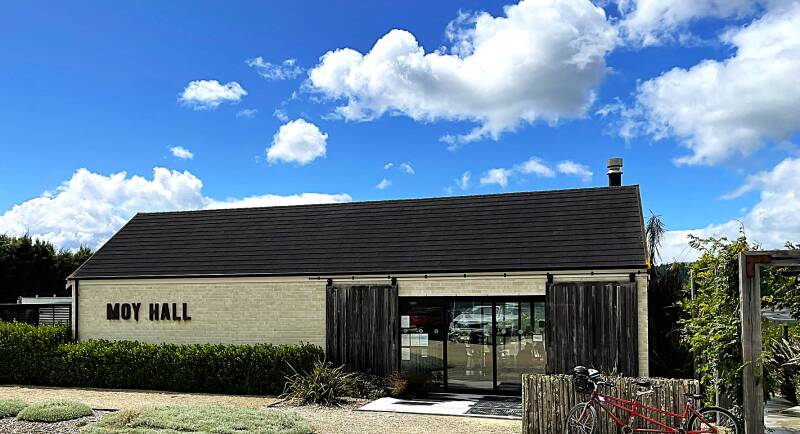
After the climb up and down those steps, and the drive on a very hazardous road, I was ready for a few....glasses of wine, of course. So it was off to Martinborough, where we stopped at the Moy Hall vineyard and winery for a delicious lunch and some very nice Sauvignon Blanc wine.
Our last destination on the North Island was the capital city of Wellington.
Wellington
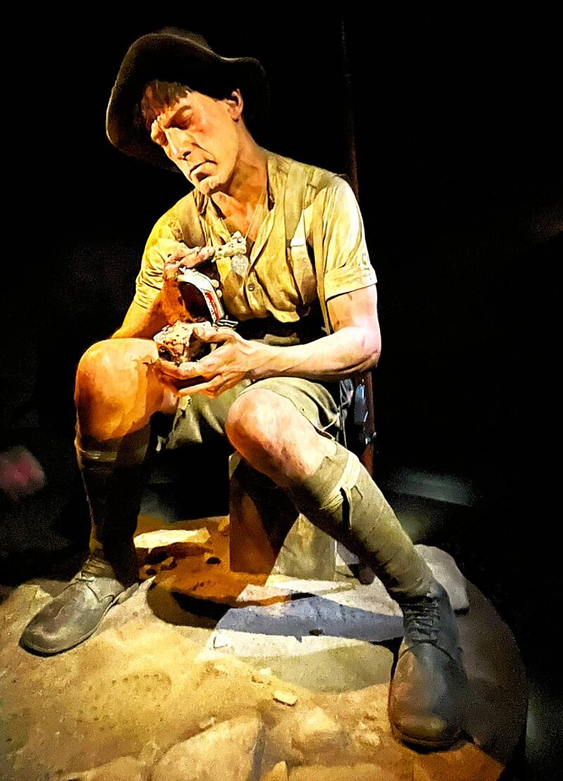
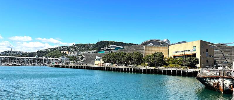
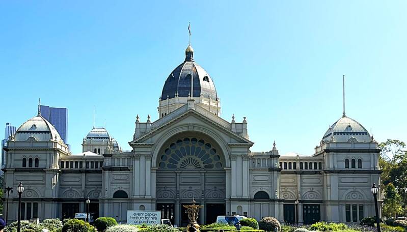
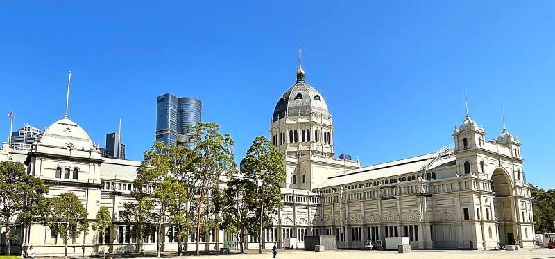
Wellington is one of the most distinctive small capitals in the world—compact, creative, and set between a dramatic harbor and steep green hills. It sits at the southern tip of New Zealand’s North Island, overlooking Wellington Harbour and facing the Cook Strait, the channel separating the North and South Islands. It is the political heart of the country—home to New Zealand’s Parliament, including the iconic Beehive (the executive wing). Wellington is widely considered New Zealand’s cultural capital. It is the film industry hub—closely tied to Peter Jackson and The Lord of the Rings films. The national museum, Te Papa Tongarewa, is one of the best in the world. Speaking of the Te Papa museum, that's where we headed on our first day in Wellington. Although many of the museums we've been in have been free, this was a fee-based museum, and after our 2-hour visit, it was money well spent. The museum is designed with exhibits on the perimeter and a large atrium in the middle. The exhibits ranged from Maori culture to New Zealand history to natural history, and finally to an incredible exhibit on New Zealanders who fought with the Allies in the World War I battle of Gallipoli, Turkey.
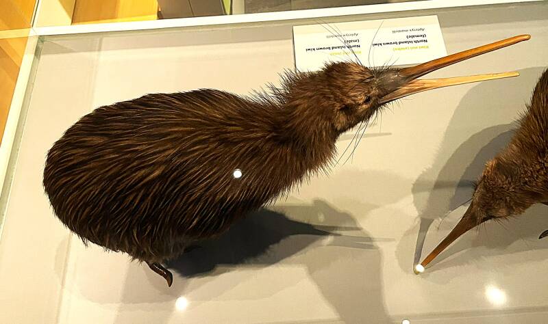
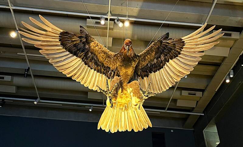
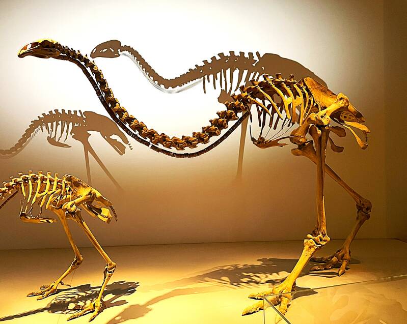
Here are pictures from the natural history section of the Te Papa museum - front top to bottom, left to right - Kiwi the National bird of New Zealand, Haast Eagle now extinct but capable of picking up small children, skeleton of a Moa which is also extinct and was a flightless bird with no wings that stood 12 feet tall and weighed upwards to 500 pounds.
Here are a few pictures from the Maori culture exhibit. Maori meeting house and woodcarving representing spirits to worship.


On our second day in Wellington we did the obligatory walking tour. We strolled through the major government building complex and then headed toward the waterfront promenade. From top to bottom, left to right - Parliament building, Executive building (aka The Beehive), statue of Prime Minister Richard Setton, state library building, waterfront statue and Te Papa museum from waterfront.


After our walking tour, we dropped off the rental car at the airport and then boarded our ship for our next port, this one in the South Island, Lyttleton/Christchurch.
Lyttleton/Christchurch
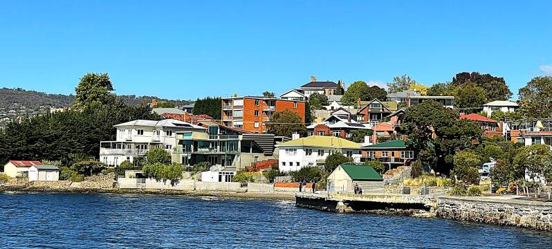
Lyttleton was our first port on the South Island. It's more famous neighbor directly to the northwest is Christchurch.
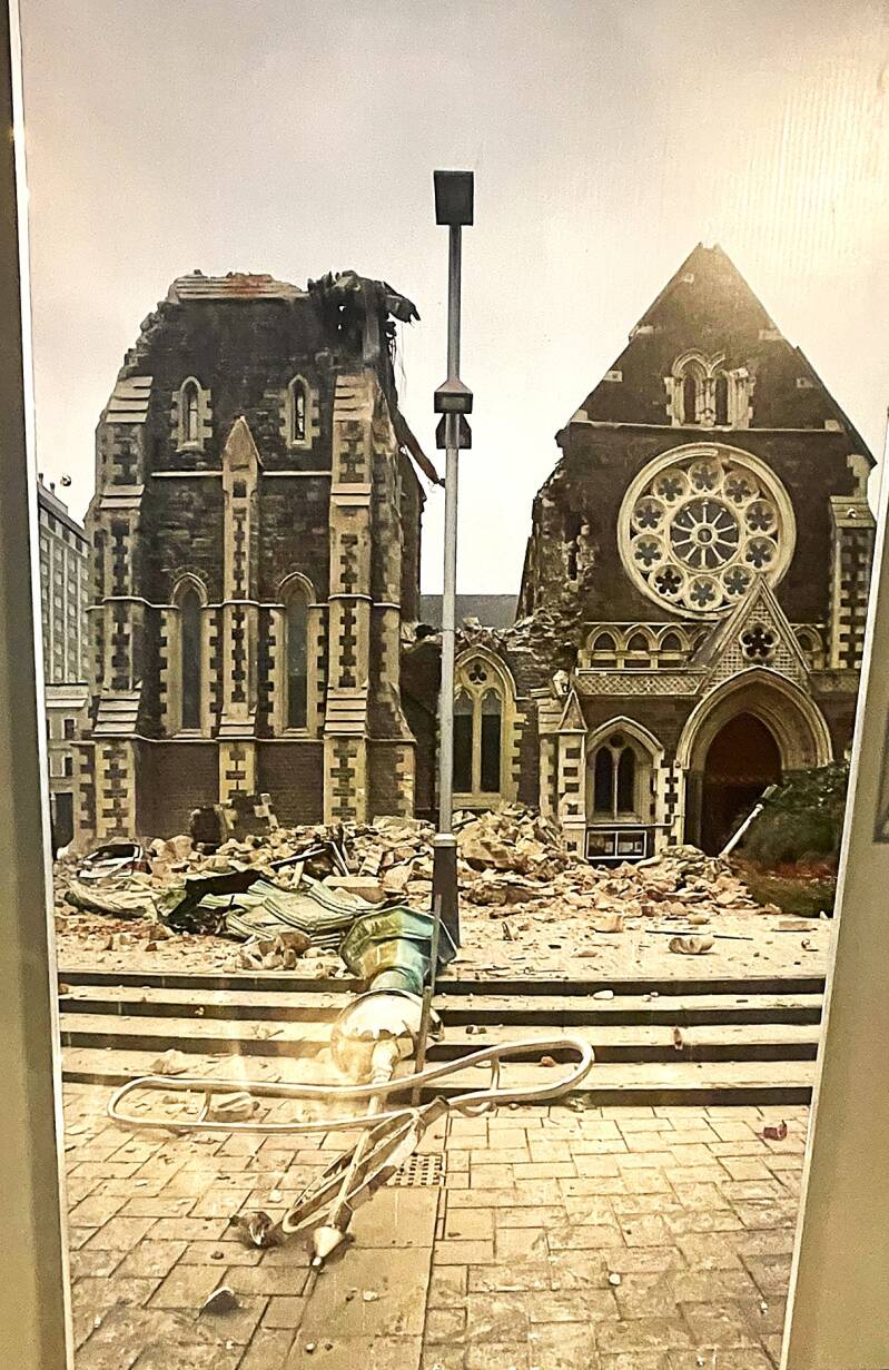
Christchurch is known as New Zealand’s “Garden City” and has a mixture of restored historic areas, new architecture, parks, and riverside spaces. The Christchurch Botanic Gardens are one of Christchurch's highlights. The gardens were established in 1863 and are often considered among the best botanic gardens in New Zealand. The most popular areas include the rose garden, especially beautiful from late spring through summer; the New Zealand native plant section; the conservatories, which contain tropical plants, orchids, cacti, succulents, ferns, and carnivorous plants; and the tree-lined walks along the Avon River. Another attraction in Christchurch is the “earthquake museum”, which is officially called Quake City. It is a small but very powerful museum that explains the devastating Christchurch earthquakes of 2010 and 2011 and how the city rebuilt afterward. The museum contains pieces of damaged buildings, including items from Christchurch Cathedral; personal stories and videos from survivors, rescuers, and volunteers; explanations of earthquakes, liquefaction, and why Christchurch was so badly affected; and displays showing how the city has changed and rebuilt since the disaster. Most visitors, ourselves included, found the human stories to be the most memorable part. From top to bottom, left to right - pictures from the Botanic flower gardens, picture of giant Euchalyptus tree (see Kathie for scale), and succulents garden. The next day we moved on to the Quake City museum where we saw a picture of the damaged cathedral with fallen spire and then the actual spire itself. Then a sign explaining the necessary response to the quake and a model of the first responders.


Jason and Heather grabbed another rental car from Christchurch and went out exploring the South Island, as Kathie and I sailed to our next port of Dunedin.
Port Chalmers/Dunedin
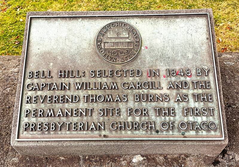
Dunedin is one of the most distinctive cities in New Zealand—a historic university city on the southeast coast of the South Island with strong Scottish roots. The city was founded in 1848 by Scottish settlers, and its name comes from the Gaelic name for Edinburgh. During the Otago gold rush of the 1860s it became one of New Zealand’s wealthiest and most important cities, which is why so much of its impressive Victorian and Edwardian architecture still survives today.
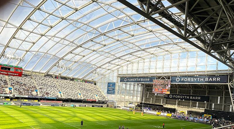
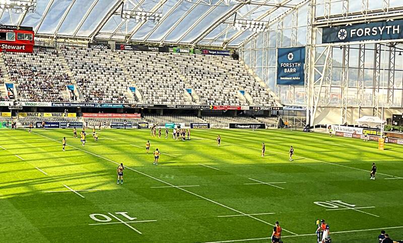
Our ship docked late in the afternoon in the quaint little city of Port Chalmers, where we met up with Jason and Heather. Our first evening there was spent attending a rugby match between the local Dunedin team and a team from Western Australia. To me, it's an interesting hybrid between American football and British soccer. Before disembarking, we had the opportunity to attend a presentation on the rules of rugby by one of our ship's New Zealand residents. She, yes SHE a former rugby player, gave us enough insight to enjoy the match. Here are a few pictures of the stadium and the players.
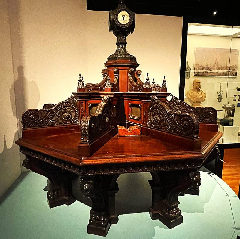
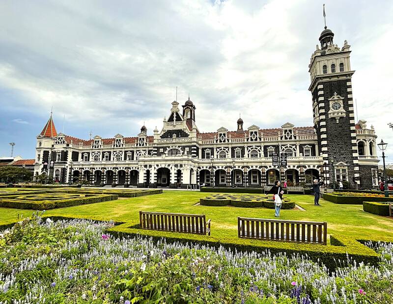
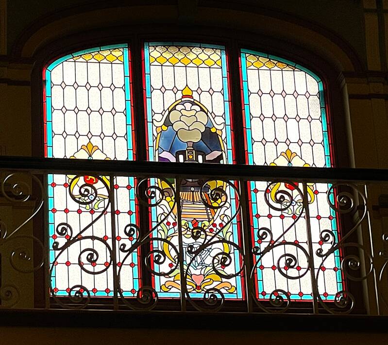
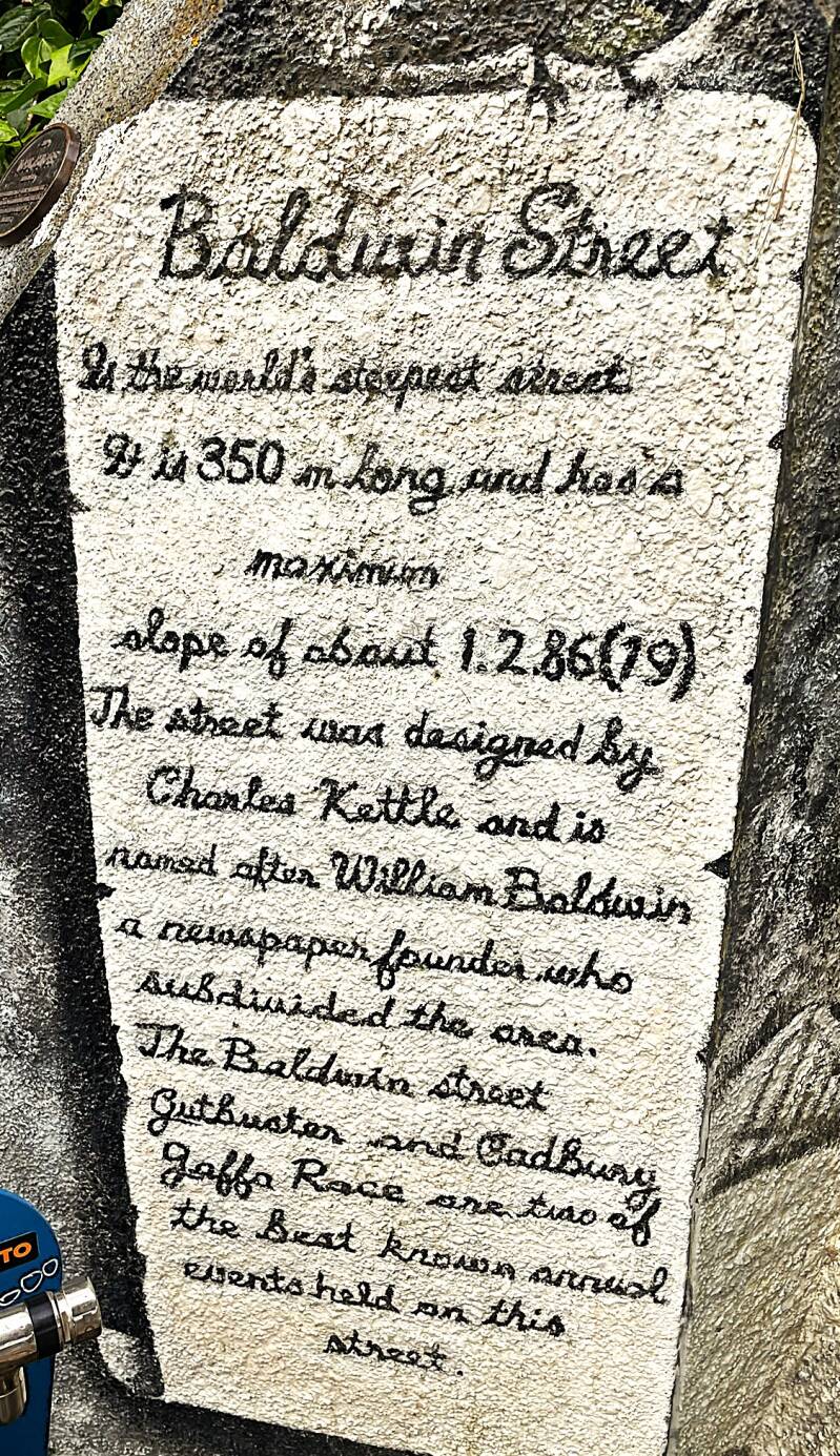
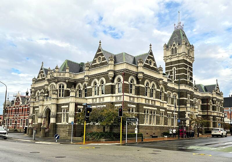
Some of the most interesting things to see in the city itself include Toitū Otago Settlers Museum – excellent for understanding the early Scottish settlement and the history of Otago; Dunedin Railway Station – one of the most photographed buildings in New Zealand, built in 1906 with elaborate stonework and stained glass and Baldwin Street - The Steepest Street in the World – famous for once being recognized as the world’s steepest residential street. Here are a few pictures from the museum, then the train station (outside and inside), and finally Baldwin Street.


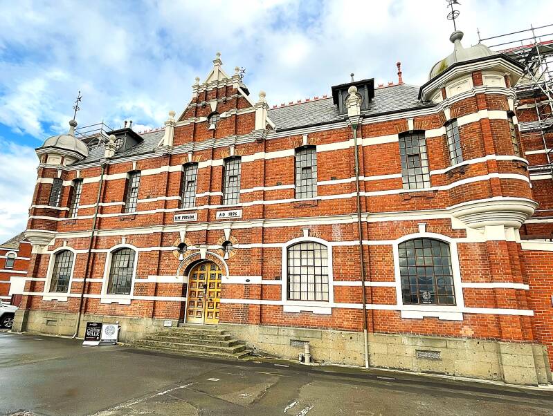
The most impressive and largest church building in Dunedin is First Church of Otago. This dramatic Presbyterian church, built from dark bluestone, has a very tall Gothic spire and sits prominently above Moray Place. It dates to the 1870s and is often photographed for its resemblance to a European cathedral. Although it is not technically a cathedral, it is considered Dunedin’s largest church building. Here's a pictures of the church and the church sign, the Dunedin Courthouse and then the jail.


Australia - Part II
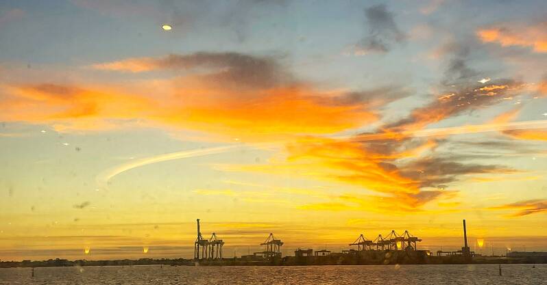
As you can probably tell by now, our ship has a way of crisscrossing across the South Pacific. So it is with this part of the blog. As I explained in the New Zealand introduction, we actually visited three ports in Australia (Cairns for the second time, Townsville, and Sydney) before heading to New Zealand. After leaving New Zealand waters, we stopped in the port of Hobart, Tasmania, and then headed on to Melbourne, Adelaide, and Fremantle/Perth. As I work on this blog, we have left Australian waters and are now heading to Bali, Indonesia....more on that in the next chapter of the blog. For those of you who are logistically minded, we traveled approximately 7600 nautical miles circumnavigating Australia between our arrival in the port of Darwin and our departure north of Perth.
Cairns the second time
As a refresher, Cairns is on the northwestern shore of Queensland AUS. It is the western border of the Great Barrier Reef, which was our destination for our second visit to Cairns. We only had two days there and day one was spent "shopping" for some necessary clothing, cabin and miscellaneous options. There is a very large indoor mall with major discount stores like Target and Kmart. Day two was our day to experience one of our bucket list items, which was snorkeling in the Great Barrier Reef. If you want to enjoy pictures of many of the fish and coral that we saw you can go back to the earlier posting on Cairns and review those that I took in the Cairns aquarium. Our snorkeling trip started the next day with a ferry ride to Fitzroy Island with our great British Columbia friends, Cindy and Barry.
Fitzroy Island
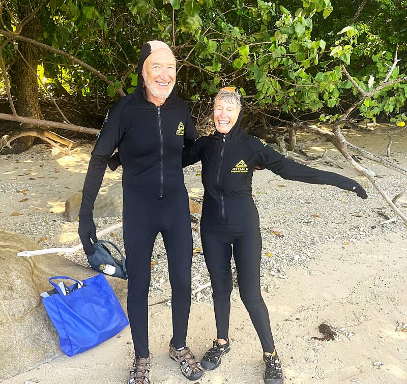
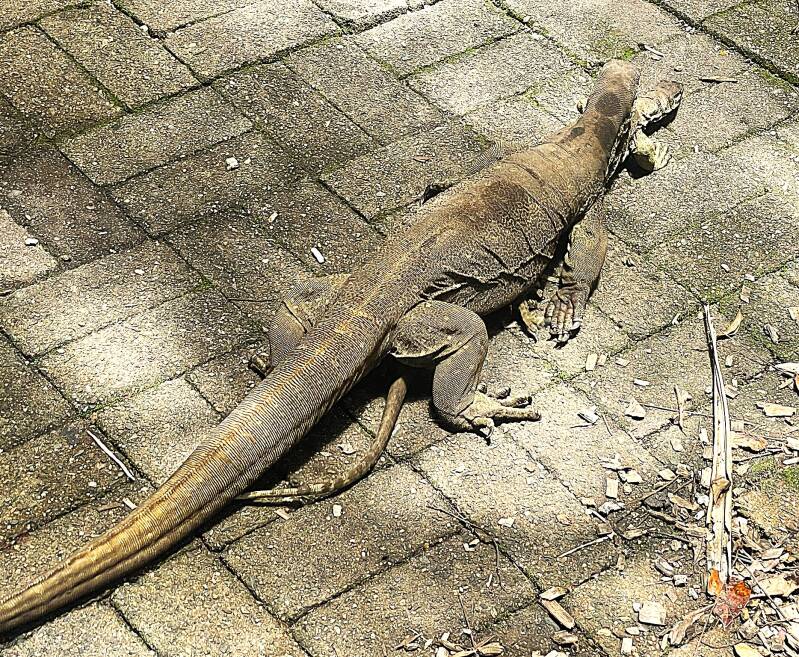
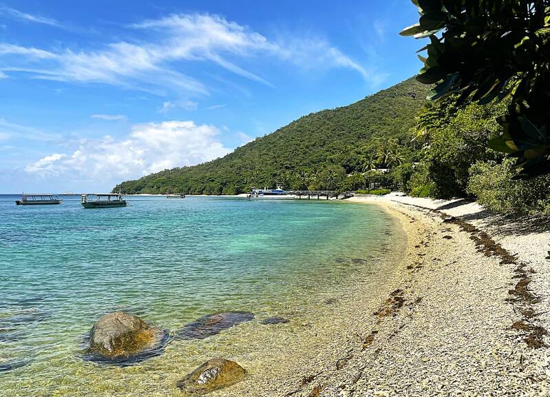
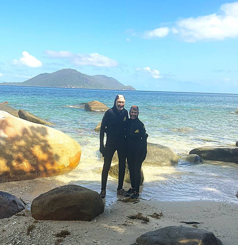
Fitzroy Island is one of the closest Great Barrier Reef islands to Cairns, about 29 km (18 miles) offshore and only a 45-minute ferry ride away. Unlike many reef islands, it is a mountainous continental island covered mostly in rainforest and surrounded by coral reefs, giving you both tropical forest and reef experiences in one place. Over 95% of the island is protected as national park. There was excellent snorkeling right off the beach, especially around Welcome Bay and Nudey Beach, where we saw coral, colorful fish, and sea turtles without taking a separate reef cruise. This snorkeling trip was made a bit more interesting because we had to dress for the possibility of encountering box jellyfish...suffice it say I did need to be told twice to don our lycra protective suits. Here's a few pictures to prove the point. While having lunch we were also entertained by watching some nearby lizards mating. Lastly here's a few pictures of the beaches that we snorkeled off of.

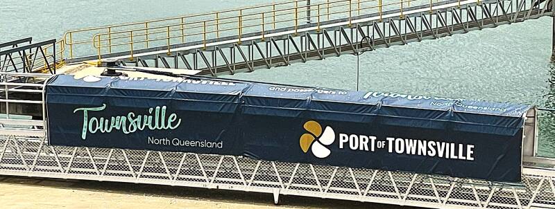
Townsville
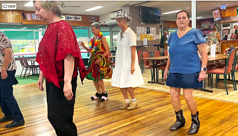
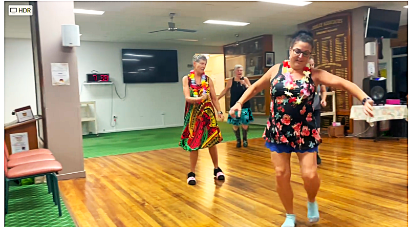
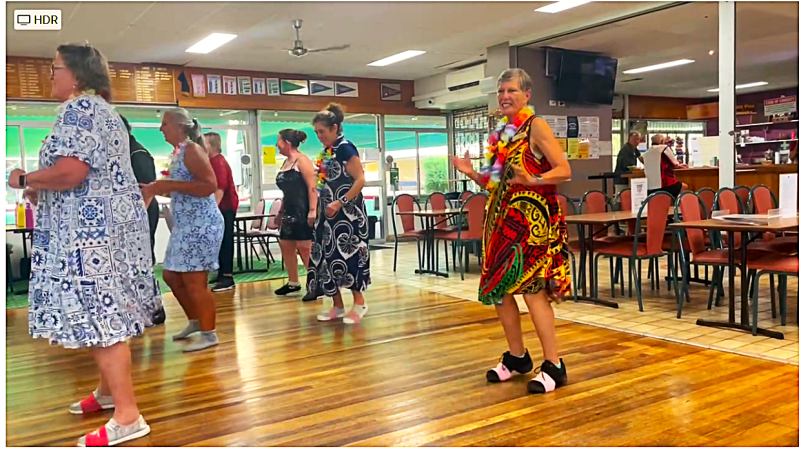
Townsville is the largest city in northern Queensland and sits on the Coral Sea about halfway between Brisbane and Cairns. It is a tropical city of about 200,000 people and is often called the gateway to the central section of the Great Barrier Reef and nearby Magnetic Island. Townsville has a more laid-back, working-city feel than the resort atmosphere of Cairns, with a strong military, university, port, and mining presence. Our original plans were to continue our Great Barrier Reef snorkeling adventures but we were advised that Magnetic Island was too dangerous because of a large population of box jellyfish...they didn't need to tell me twice so we scrubbed that from our to do list and instead focused on preparing for one Kathie's big cultural exchange events - line dancing with the ladies from Townsville Tropical Boots at a local lawn bowling venue. If the dancer is wearing a lei, they are from the ship; otherwise, they are local ladies.

Sydney
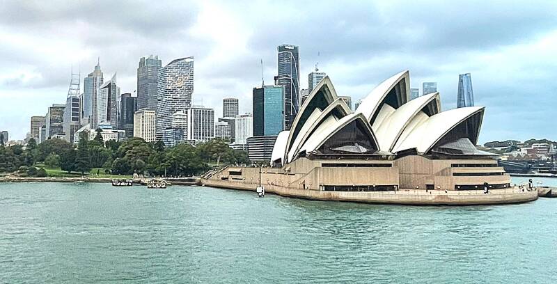
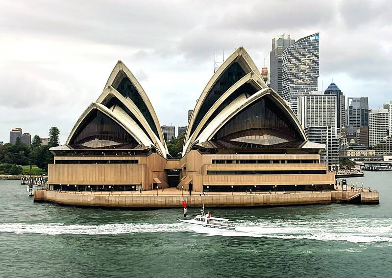
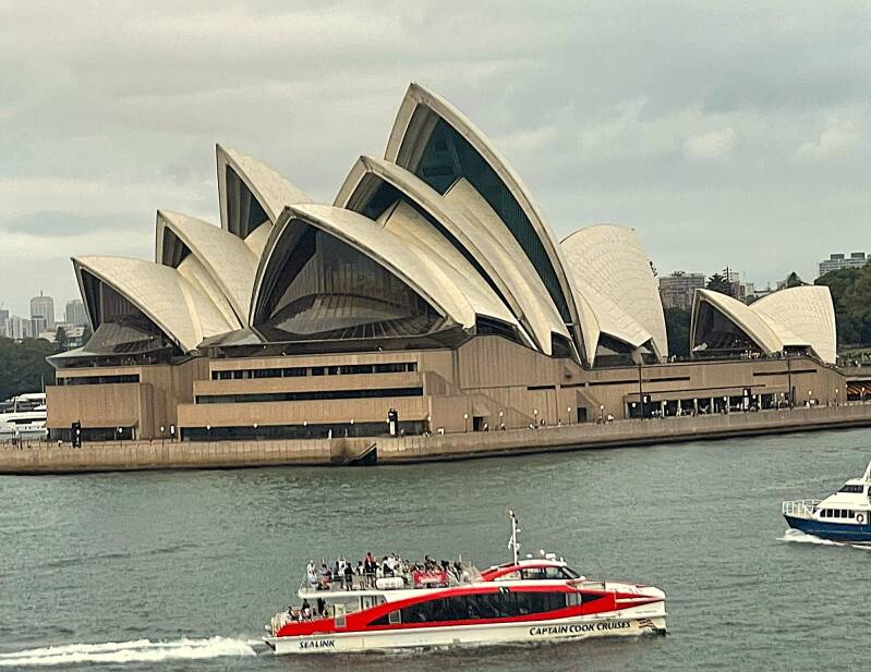
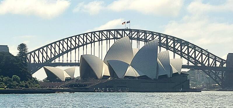
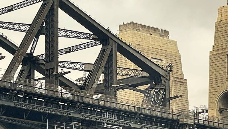
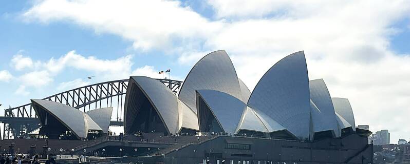
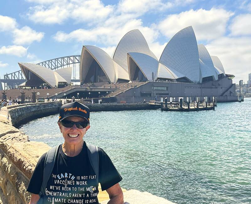
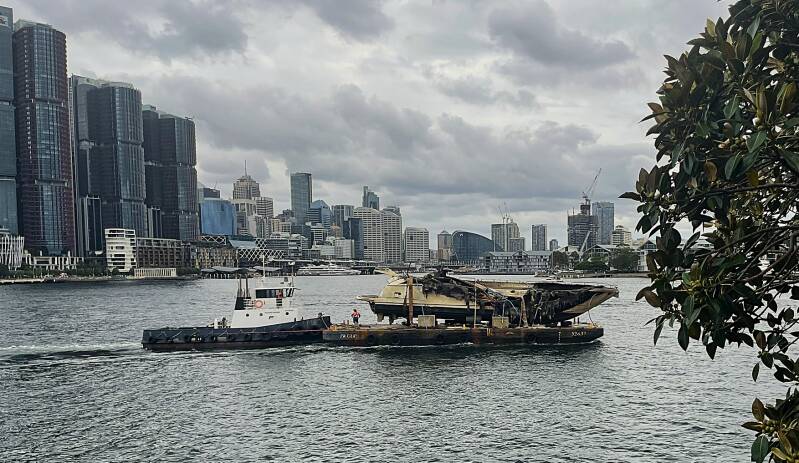
Sydney is Australia’s largest and most internationally recognized city, built around one of the world’s great natural harbors. Located on the southeast coast of New South Wales, Sydney has a metropolitan population of just over 5 million and is the country’s financial, cultural, and tourism center. The city was founded in 1788 as Australia's first European settlement and has grown from a British penal colony into a modern, multicultural metropolis. The two most famous landmarks are the sail-shaped Sydney Opera House and the giant arch of the Sydney Harbor Bridge. The Opera House sits on Bennelong Point and is one of the most recognizable buildings in the world, while the Harbor Bridge connects the city center with the North Shore and can even be climbed for panoramic views. Here are a few pictures of these iconic structures taken from the ship as we pulled into Sydney Harbor. Look for the bridge climbers in the last picture in this series.
Because public transportation in Sydney was so inexpensive and available, we took bus rides into the center of Sydney where we immersed ourselves into Sydney's early history. Before I jump into the pictures part of this blog, here's a little bit of a Sydney history lesson.
Before the British arrived, the Sydney area had been inhabited for tens of thousands of years by Aboriginal peoples, especially the Eora nation around the harbor. The land around present-day Sydney Cove, Circular Quay, and the harbor was already home to established communities with their own languages, fishing grounds, and trading routes.
In the 1780s Britain faced overcrowded prisons and prison ships after it lost the American colonies, where convicts had previously been sent. The British government decided to establish a new penal colony on the far side of the world in New South Wales. Australia was also attractive because Britain wanted a strategic base in the Pacific and hoped to prevent French expansion in the region.
In May 1787, the so-called First Fleet left England. It consisted of 11 ships carrying roughly 1,400–1,500 people, including about 736 convicts. The remainder were marines, sailors, government officials, and a few free settlers. The convicts were mostly people convicted of theft and other relatively minor crimes, although some had committed more serious offenses.
The relationship between the British and the Aboriginal people around Sydney was complicated and often tragic. Smallpox and other diseases devastated Indigenous communities soon after the British arrival. By the early 1800s Sydney was beginning to change from a prison camp into a town. More free settlers arrived, convicts completed their sentences, shops and businesses appeared, and stone buildings gradually replaced tents and huts. The old convict outpost around Sydney Cove eventually grew into the modern city of Sydney.
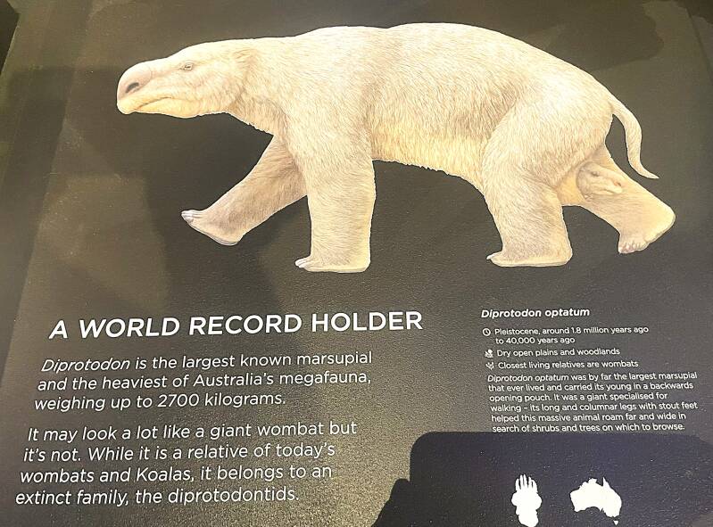
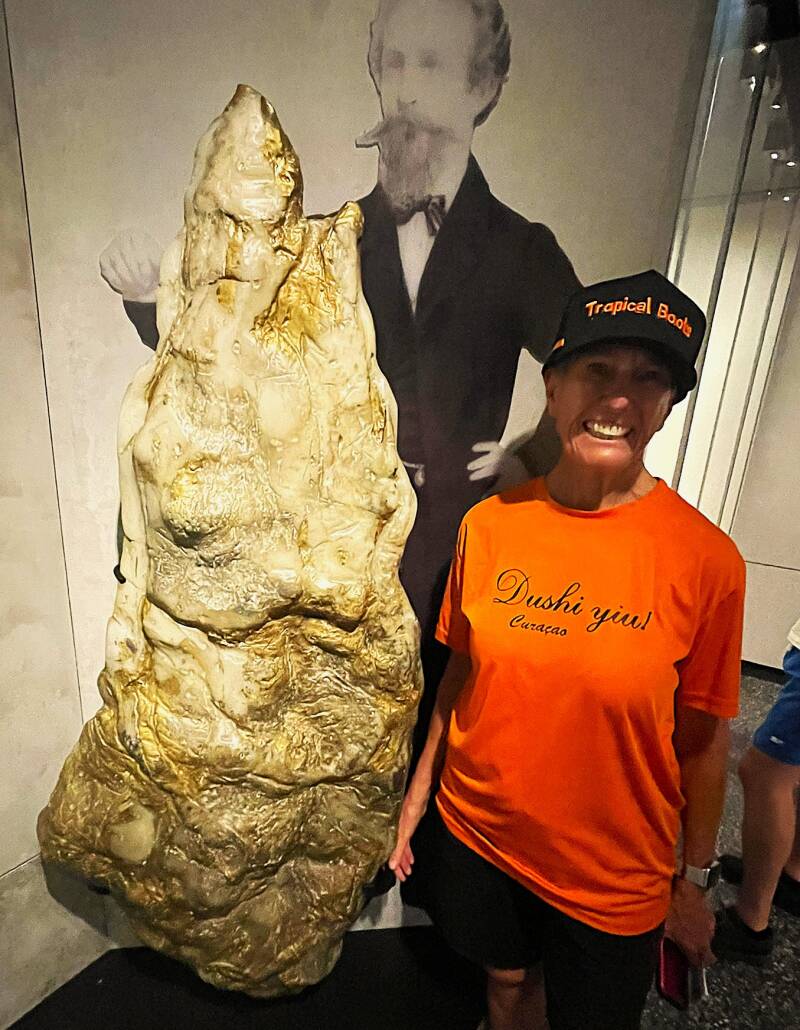
Okay, enough history, let's move on to our tour around Sydney. First up was the Australian National Museum, a natural history museum full of "things" you see in such museums. From top to bottom, left to right - Iconic boomerang display, a fish sculpture made up of ghost nets, which are abandoned fishing nets, Australian Slave Trade sign, extinct giant kangaroo and wombat, T. rex autopsy sign and picture, and a replica of the largest gold nugget ever found.


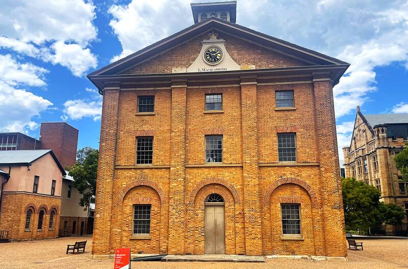
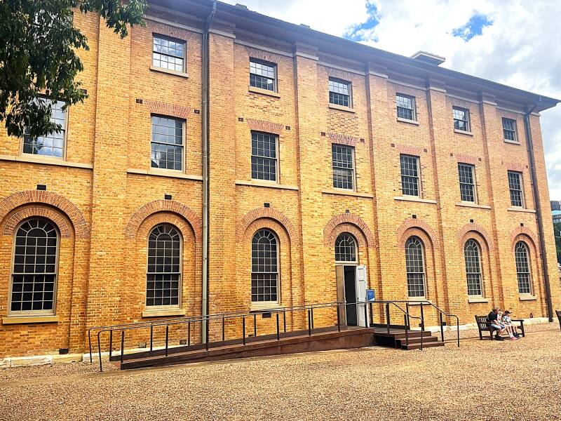
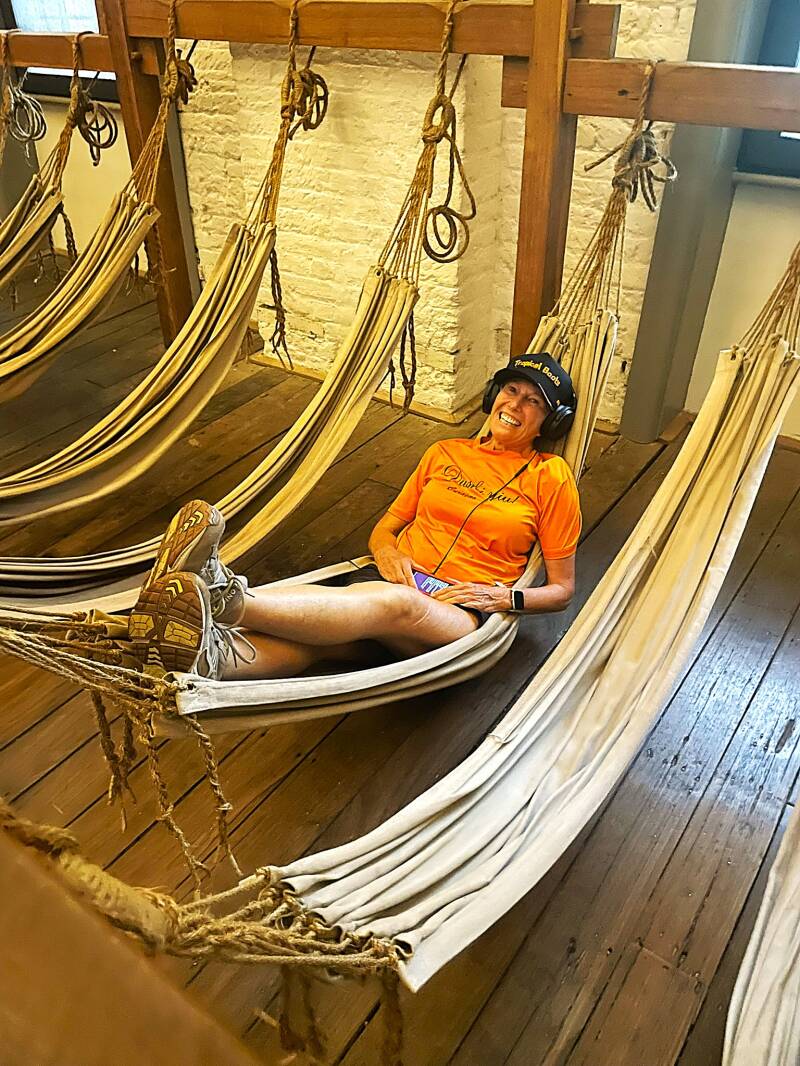
Our next stop on the walking tour was the Hyde Park barracks. Built between 1817 and 1819 during the governorship of Lachlan Macquarie, it was designed by convict architect Francis Greenway to house male convicts working in Sydney. Before the barracks were built, convicts often found their own lodging around the town, which led to disorder, drinking, theft, and poor supervision. Macquarie wanted them all gathered in one place where they could be watched and sent out to work each day. The building was intended to hold about 600 men, but at times more than 1,200 convicts were crammed inside. Around 30,000 men and boys passed through the barracks between 1819 and 1848. From top to bottom, left to right - Governor Macquaire statue, front and side views of Hyde Park barracks and sleeping accommodations with live model :-)


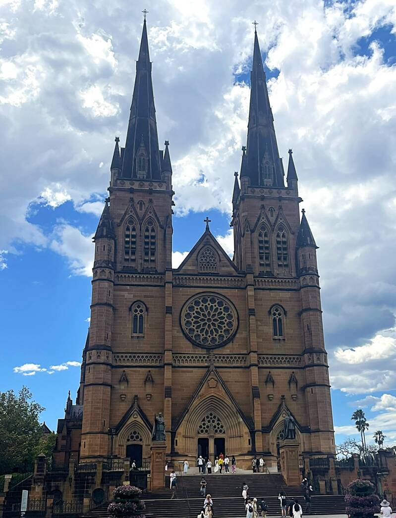
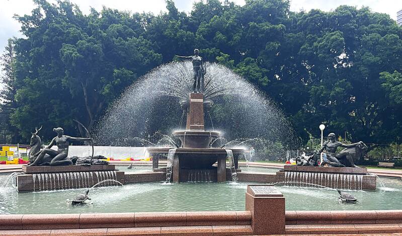
On our way back to the bus stop, we stopped to explore two more Sydney icons. First St. Mary's Catholic Cathedral, built in 1882, and then a stroll through Hyde Park, where we saw the Archibald Memorial Fountain, built in 1932.


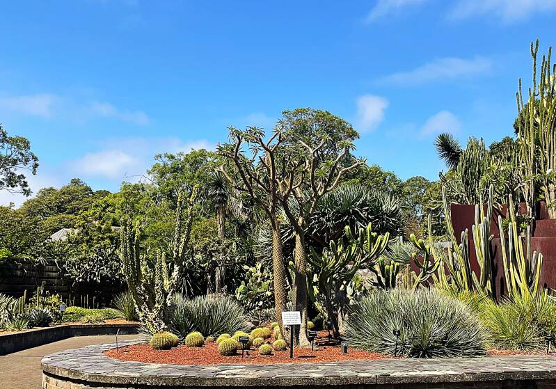
Our second day in Sydney started with an interesting bus trip. We thought we had gotten on the same bus as the day before, but by the time this bus finished its route, we were farther from downtown Sydney than when we started... oh well, you win some and lose some. Our next bus trip was successful, and we headed toward the world-famous Sydney Botanical Gardens. Again, my apologies to those of you who are not plant and flower lovers, but there are some very important people in my life who are. So without further ado, here's some of what Sydney has to offer.


After strolling the gardens we followed a waterfront path towards the Opera House. Here's a few pictures as we approached.
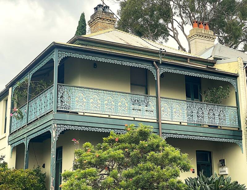
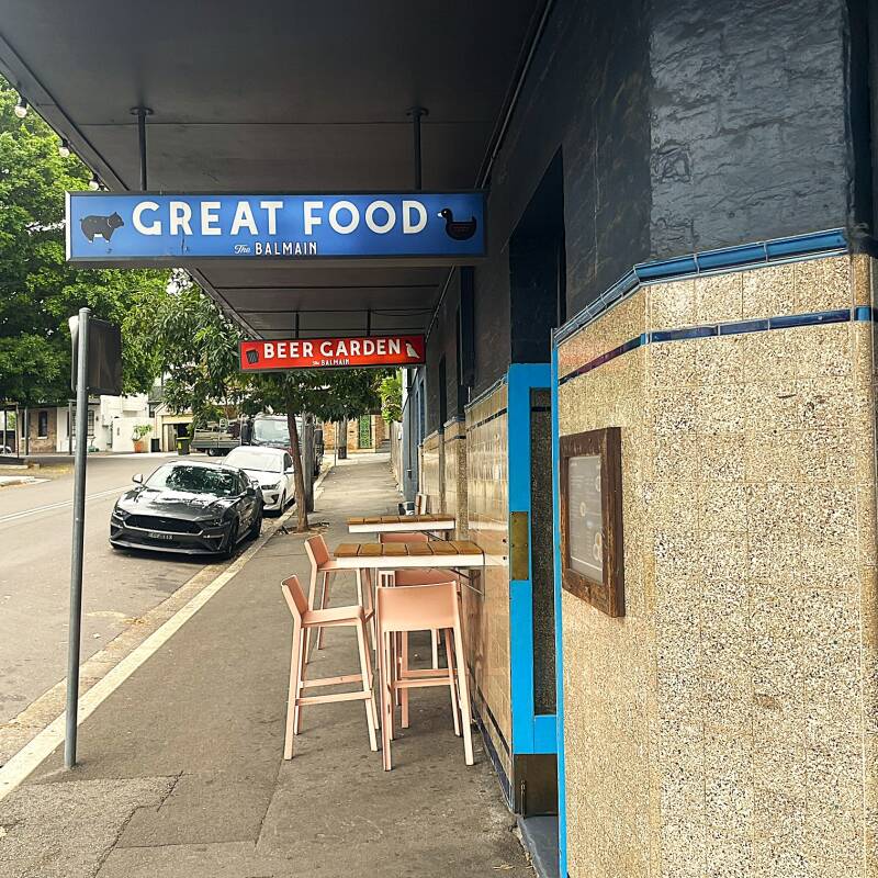
Because of the changes to our itinerary changes, we were afforded a third day in Sydney. Instead of heading to the city center, we opted to take a longer walk and ended up in one of Sydney's many neighborhoods - Balmain. Balmain is one of Sydney’s most historic and character-filled inner-harbor neighborhoods, located just a couple of miles (about 3 km) west of the central business district on a peninsula jutting into Sydney Harbour. Balmain began in the early 1800s as a land grant to colonial surgeon William Balmain, but it quickly evolved into a working-class, industrial suburb. Today, Balmain has transformed into a gentrified, upscale area—but it has kept much of its old charm, including rows of beautifully preserved Victorian terrace houses, a strong village feel despite being close to downtown Sydney, and a lovely waterfront promenade. Here are some pictures from the neighborhood and our waterfront walk. The picture with Kathie has our ship, the Odyssey, in the background.


Our port visits are never complete without a stop at a local pub...in this case, it was the Balmain Hotel, where we had a pint of Guinness and watched a rugby match as we amazed our barmaid with tales of our travels.

After Sydney we cruised for 5 days to New Zealand, which I've already covered previously in this section of the blog. After leaving New Zealand, again with another 5 days of cruising, we arrived at the port of Hobart Tasmania.
Hobart Tasmania AUS
Tasmania is Australia’s only island state, located about 150 miles (240 km) south of the mainland across the Bass Strait. It’s known for its rugged wilderness, clean air, rich history, and slower pace of life—a sharp contrast to mainland cities like Sydney or Melbourne. Nearly 40% of Tasmania is protected in national parks and reserves. Tasmania is famous for unique and often elusive animals such as the iconic Tasmanian devil and wombats, wallabies, and echidnas.
Hobart is the capital and largest city of Tasmania, with a population of about 250,000. It’s Australia’s second-oldest city (after Sydney), founded in 1804. Like early Sydney, Hobart began as a penal colony. Convicts made up a large portion of the population. The blend of convict heritage, maritime history, and colonial architecture gives Hobart its distinctive character today.
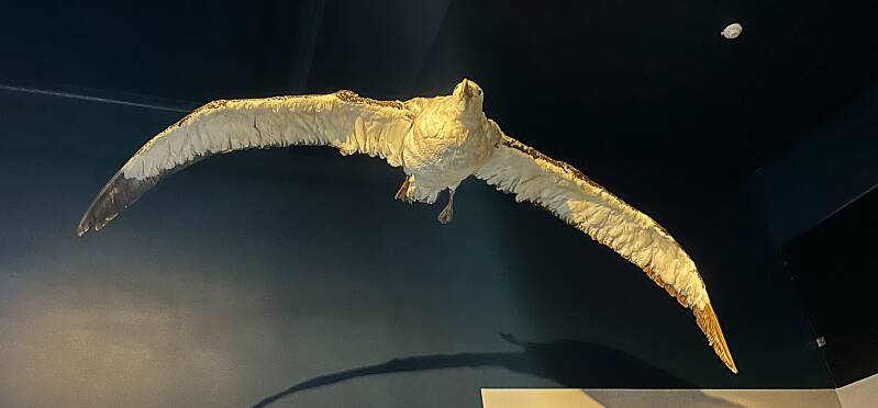
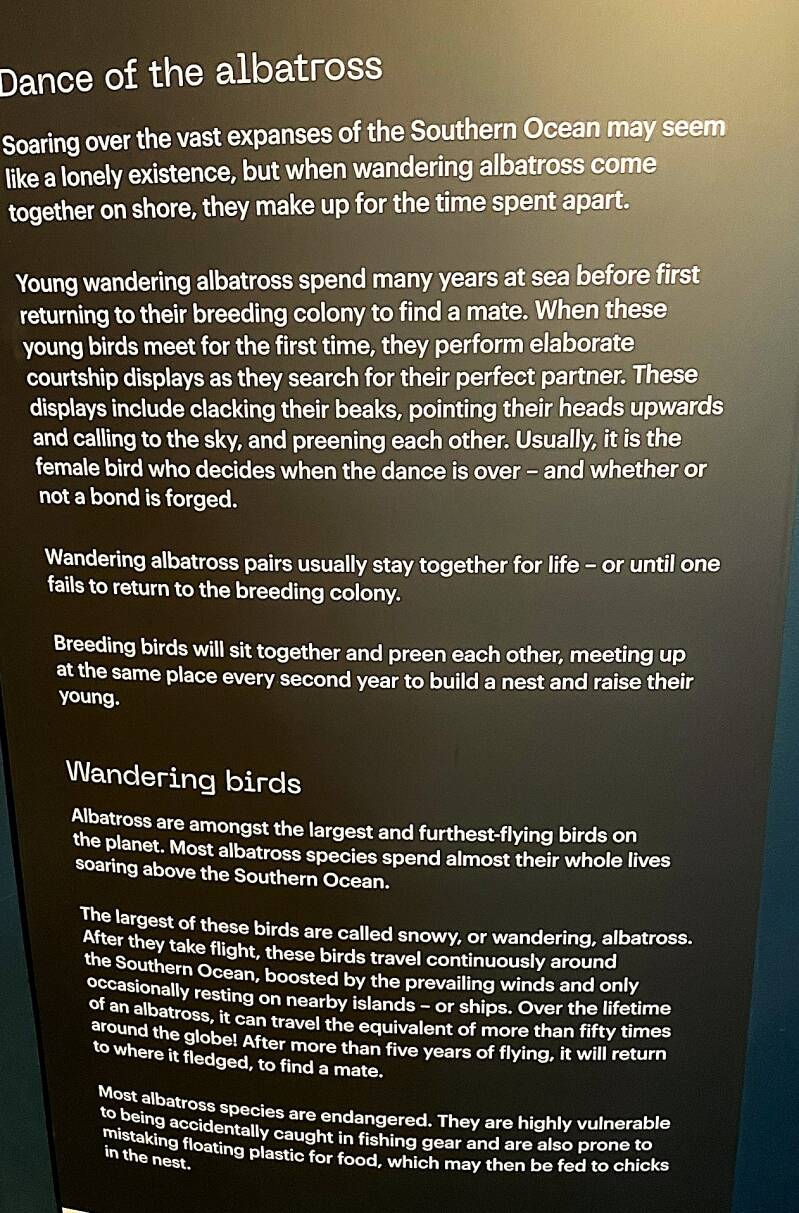
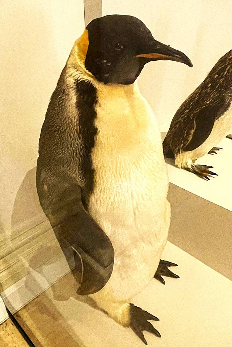
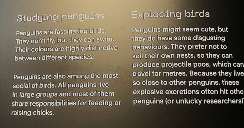
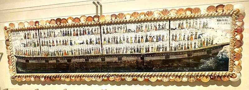
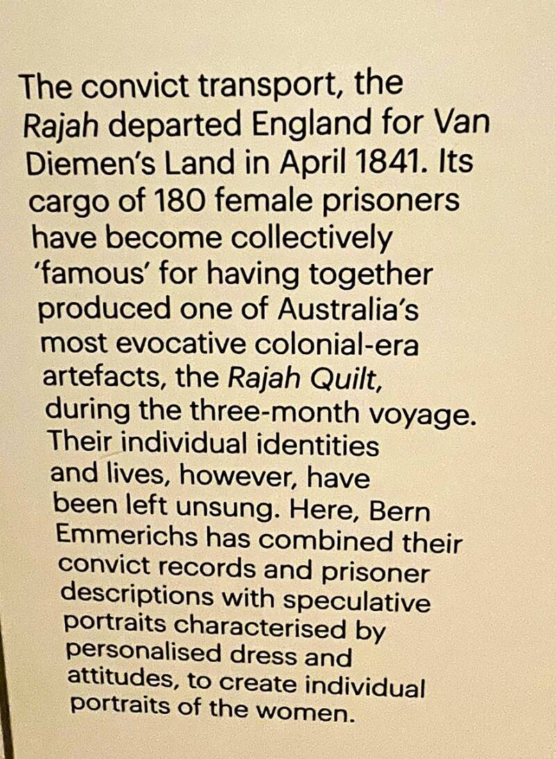
Our first day in Hobart was short because of our arrival time. We stayed close to the cruise terminal and visited a local Hobart museum, the Tasmanian Museum and Art Gallery. As with many of the other museums, this contained a combination of natural history, geographical history, and local art. From top to bottom, left to right - now extinct Tasmanian tiger and "cute" devil, Giant albatross and sign, Emperor penguin and penguin sign, Lego model of Icebreaker/research ship and cutaway,, and painting of a ship carrying female convicts and sign.


Our second day in Hobart involved a rental van and a self guided tour of an animal rescue facility, a tour of wine country and tasting and then a walking tour of Richmond TAS.
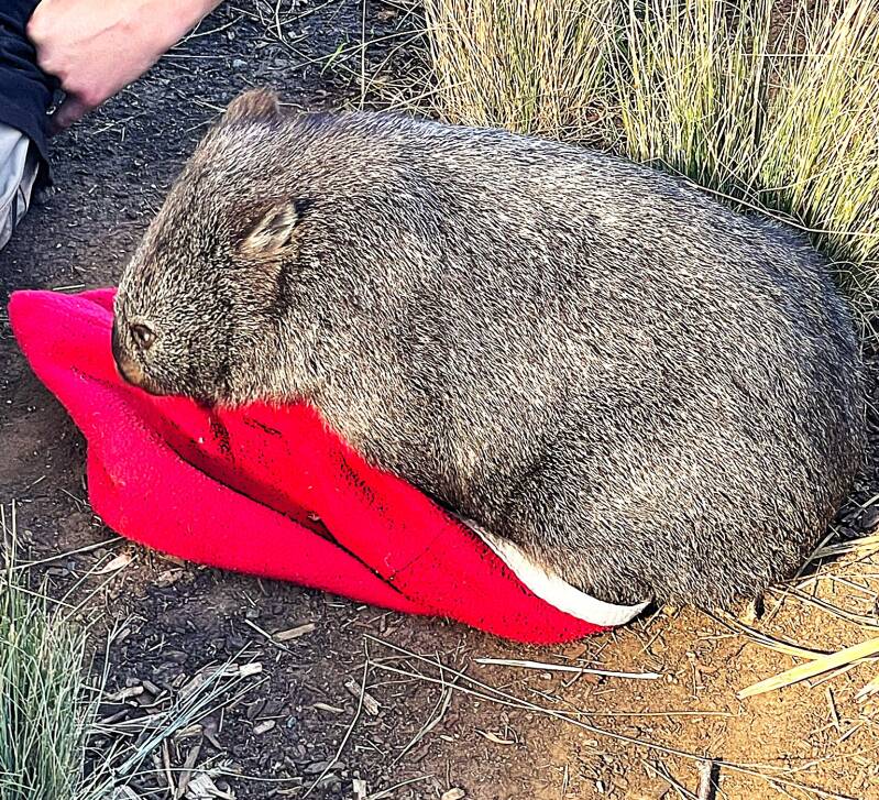
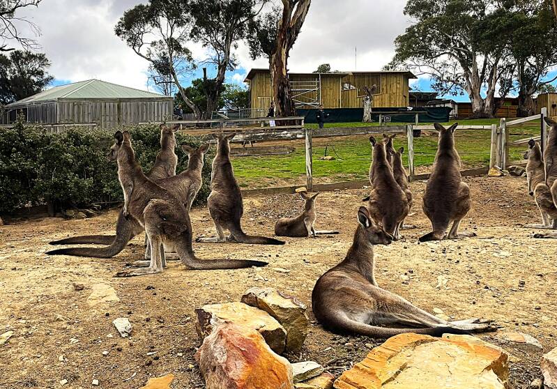
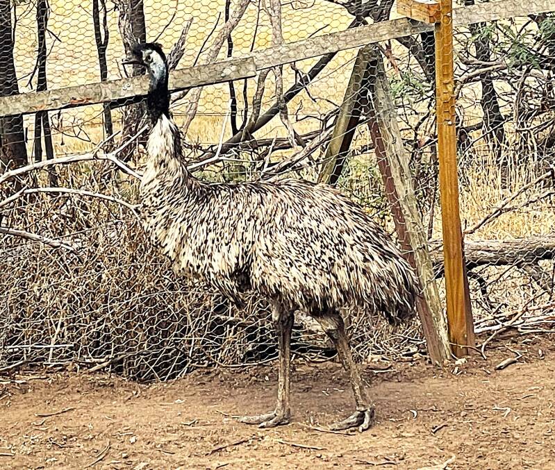
The Bonorong Animal Rescue facility was about 30 minutes outside of Hobart. The facility operates on a 7/24/365 schedule and responds to calls from concerned Tasmanians who have observed an animal in distress. The facility dispatches volunteers to assess the situation and then, if necessary, rescue the injured animal. When the animal arrives at the facility, a veterinary team and the medical facility provide the appropriate treatment. From here, the animal is quarantined until it joins the other animals in an open public area. From top to bottom, left to right - Our Bonorong guide and recovering wombat, Tasmanian devil at rest and eating lunch, a mob (look it up) of eastern gray kangaroos, and Kathie feeding one, a wallaby, and an emu.


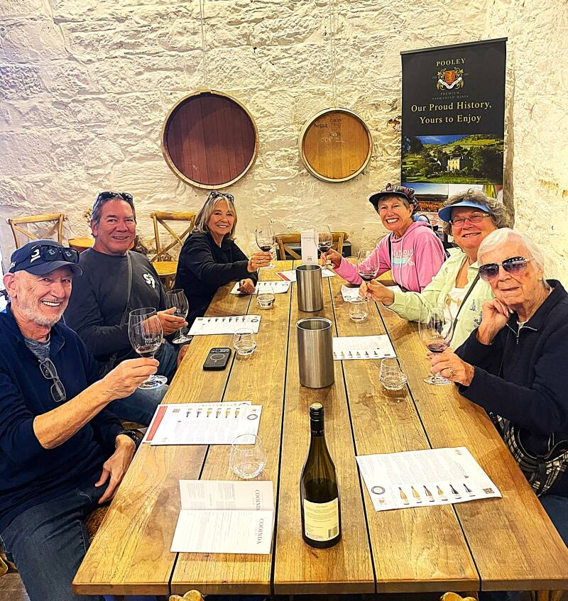
After leaving the Bonorong facility we headed into wine country and stopped at the Pooley winery for a tasting. The unfamiliar faces belong to our friends Barry and Cindy, on the left and Diane and Beryl on the right.
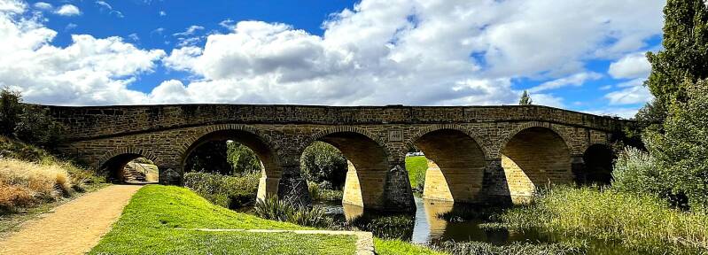
From the wine tasting we headed to the historical city of Richmond, where we had a delightful lunch and of course another glass of wine. We decided to stretch a legs a bit after lunch so we took a little stroll through town. Here's a stone bridge built in 1823 and the town hotel.
The last day in Hobart involved a walking tour of Battery Point. The name comes from a battery of guns built in 1818 to defend Hobart’s harbor. It’s widely regarded as one of Hobart’s most prestigious and picturesque areas, filled with preserved 19th-century cottages, narrow lanes, and heritage homes. Here's a picture of the neighborhood taken from Derwent river.
Melbourne AUS
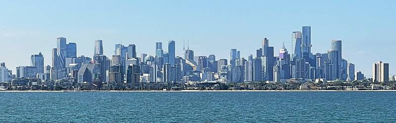
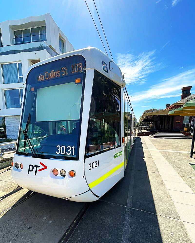
Melbourne is the capital of the state of Victoria and Australia’s second-largest city, with a metropolitan population of more than 5 million. Many visitors compare parts of the city center to those of European cities because of the tram network, old stone buildings, tree-lined boulevards, arcades, and café-lined laneways. Melbourne has one of the largest tram systems in the world, and the trams are one of the city’s icons. Public transportation is generally excellent, with trains, trams, and buses making it easy to explore the city without a car.
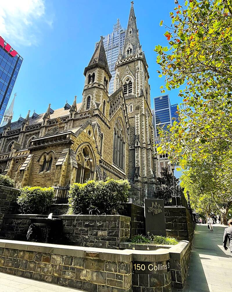
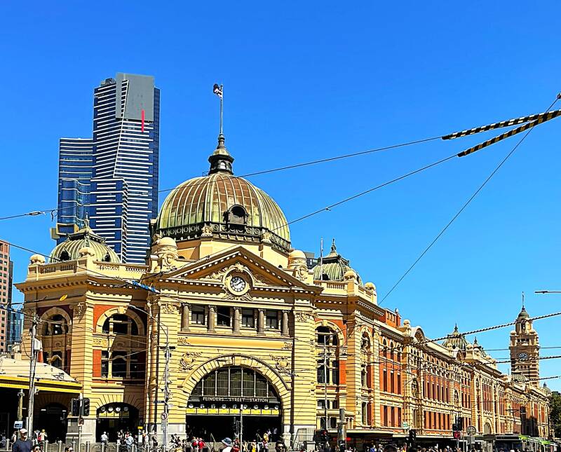
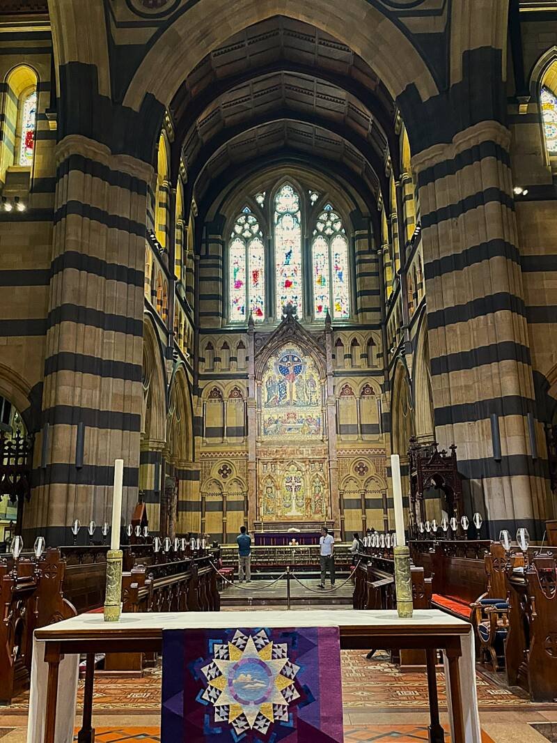
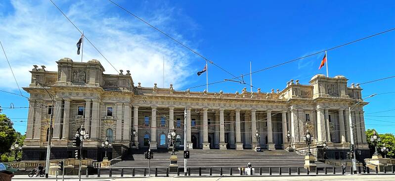
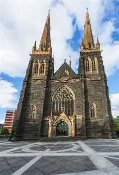
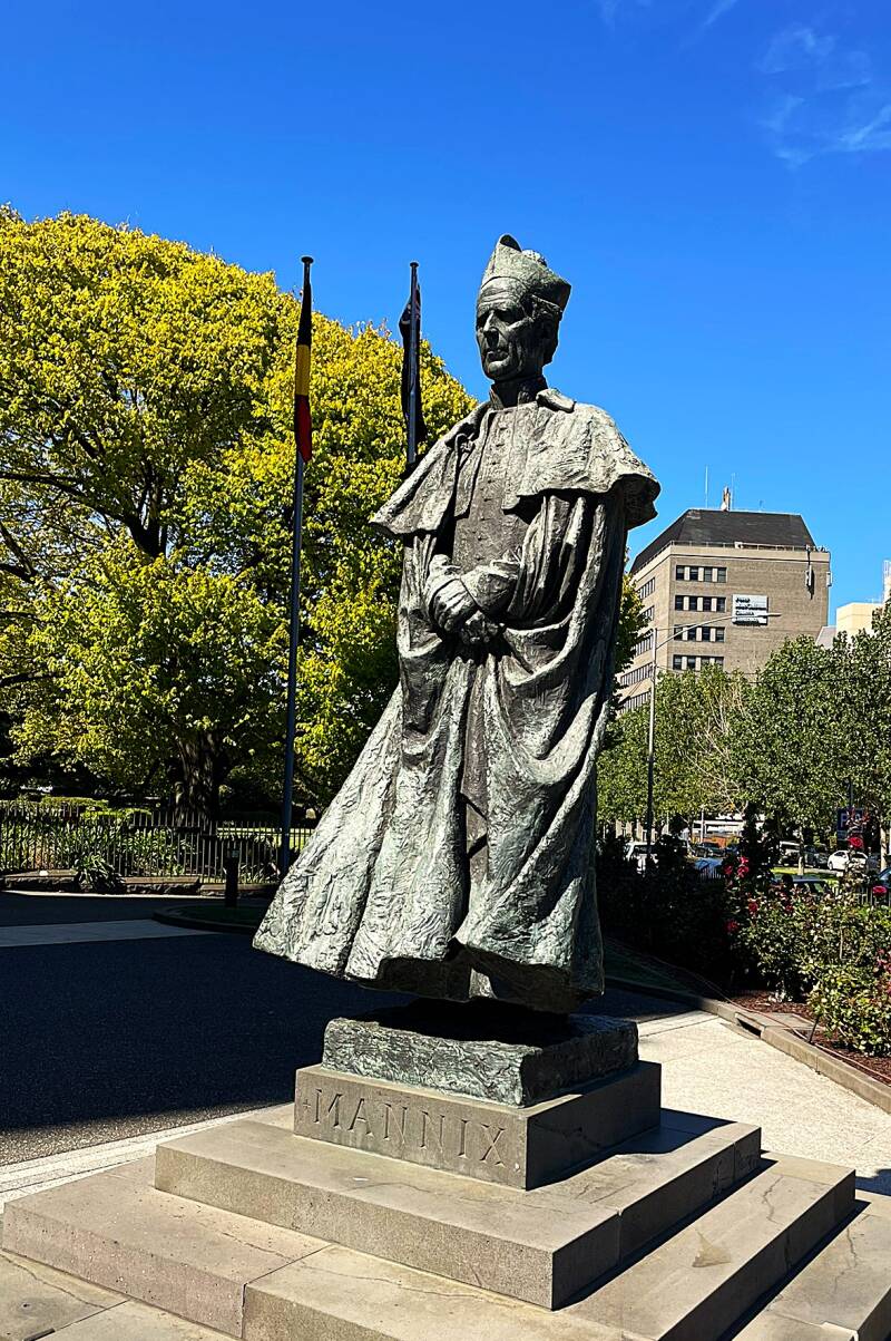
Here's a picture of the Melbourne skyline as we pulled into port. Then speaking of trams, here's number 109, which stops right outside the pier where we were docked. We took this tram into the central business district, where we headed off on a walking tour. The central business district of Melbourne is a fascinating mix of new ultra-modern buildings alongside late-1800s and early-1900s stone buildings. After getting off the tram we passed, from top to bottom, left to right - Scotts Church, Forum Theater, Flinders Street train station, exterior St. Paul's Cathedral, interior St. Paul's, altar and pipe organ of St. Pauls, State of Victoria Parliament building, front and side views of St. Patrick's Catholic Cathedral, Statue of Archbishop Daniel Mannix who was archbishop of Melbourne for 46 years and skywriter "heart" sign that was timed to occur just as a wedding in St. Patrick's came out of the church.


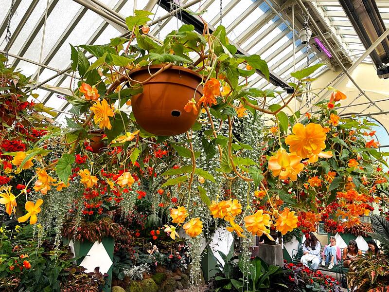
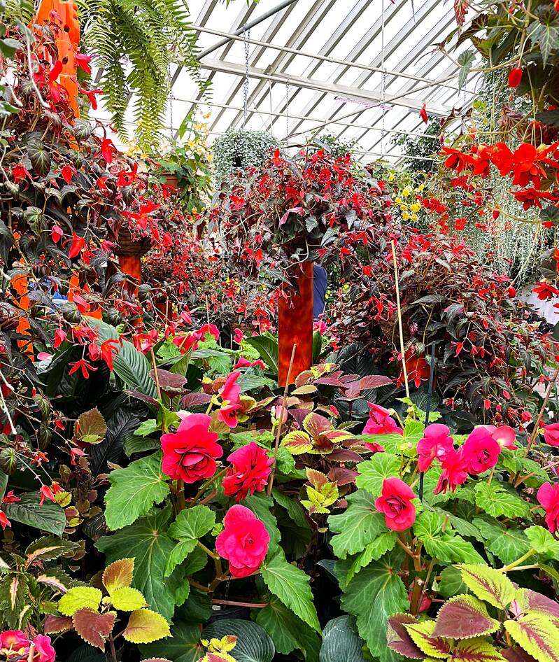
For our afternoon stroll we needed to escape the hustle and bustle of the city so we headed over to Fitzroy Gardens in east Melbourne. Originally set aside as a reserve in 1848, the gardens were named after Sir Charles Augustus Fitzroy, Governor of NSW. The gardens were laid out in 1859 and the layout follows a classic Victorian era design, featuring pathways lined with magnificent elm trees, known to be some of the best grown in Victoria. As is usually the case, we immediately headed to conservatory to sample the Melbourne version of a flower garden. Here's some pictures from the conservatory.

Directly adjacent to the conservatory was Cook's Cottage. The cottage was constructed in 1755 in the English village of Great Ayton, North Yorkshire, by the parents of Captain James Cook, James and Grace Cook. The building was purchased, dismantled brick by brick and brought to Melbourne in 1934 by the Australian philanthropist Sir Russell Grimwade. Here's the cottage and statue of Captain James Cook, English explorer and discover of Australia.


The next day we hopped on Tram 109 and we back into downtown Melbourne where we went to the Melbourne Museum. It is a natural and cultural history museum located in the Carlton Gardens in Melbourne, Australia. Located adjacent to the Royal Exhibition Building, the museum was opened in 2000 as a project of the Government of Victoria, on behalf of Museums Victoria which administers the venue. Before we get into some of the museum exhibits, here's front and side views of Exhibition Building. The Royal Exhibition Building is a UNESCO World Heritage-listed building built in 1879–1880 as part of the international exhibition movement.
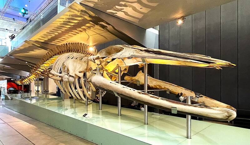
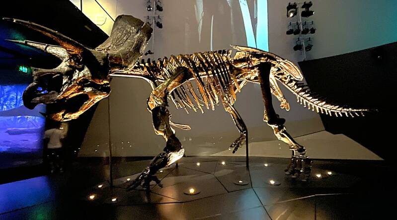
By now you're probably getting as tired as I was having to see more natural history exhibits. So I'll keep this short with only two exhibits of note - skeleton of a Blue whale, which are the largest animals ever known, reaching lengths of up to 30 meters (100 feet) and weights of 180–200 metric tons, feeding almost exclusively on krill and inhabiting oceans worldwide. The second is the skeleton of a Triceratops dinosaur. The Triceratops skeleton, known as Horridus, is a remarkable find that showcases the most complete and finely preserved Triceratops fossil ever discovered, with 266 bones and 85% of the skeleton intact.
Saying goodbye to Melbourne
Adelaide AUS
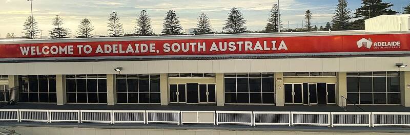
Adelaide is the capital of South Australia and is often described as Australia’s most relaxed major city. With a metropolitan population of about 1.4 million, it is much smaller than Sydney or Melbourne, which gives it a slower pace, easier traffic, and a more approachable feel. The city was founded in 1836 and was unusual for Australia because it was established as a free-settled British colony rather than as a penal colony. It was laid out by surveyor Colonel William Light in a neat grid surrounded by parkland, a design still very visible today.
Adelaide’s city center, or CBD, is compact and easy to walk. The heart of downtown is around Victoria Square, with major streets such as North Terrace, Rundle Mall, and King William Street. North Terrace is especially important because it contains many of the city’s major cultural institutions, including the Art Gallery of South Australia, the South Australian Museum, the State Library of South Australia, and the University of Adelaide. The city center is only about a mile across, so most visitors find it easy to explore on foot.
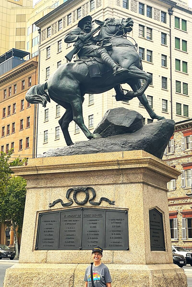
On our first day, we took a local train from the port directly into the city center. When we emerged from the Adelaide train station, we were on North Terrace Avenue, which provided easy access to many of the major points of interest. For me, Adelaide was a city full of statues - from top to bottom left to right - War Memorial, Commander Matthew Flinders who was an English explorer that was the first to circumnavigate Australia (1801-1803) proving it was an island, Mary Lee (1821–1909) was a pioneering social reformer in Australia, best known for her leadership in the movement for women’s rights and suffrage in South Australia, Settlers statue, Queen Victoria statue and the sculpture in front of the Art Museum.


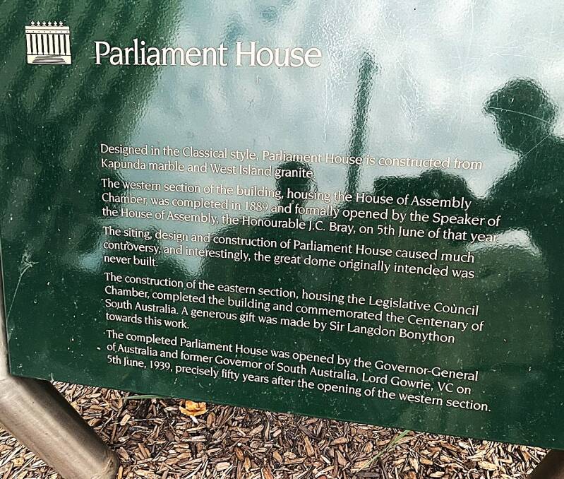
In addition to statues, Adelaide also had some impressive stone buildings - from top to bottom, left to right - Parliament building and sign, Art Museum, Government building, Science building, Town Hall.


And of course let's not forget the church. Here's front and side views of St. Francis Xavier Catholic cathedral and a statue of St Francis in the church and statue outside of the church.


Our second day in Adelaide started the same as the first, with a train ride into the city center. This time, we opted to take a stroll around some of the more modern parts of the city. We found a pedestrian street mall with several interesting sculptures.....see below.


Then we headed down the street to the National Wine Center. The National Wine Center of Australia is one of Adelaide’s most popular attractions for wine lovers. The center is designed to showcase Australian wine from across the country rather than focusing solely on South Australia. Inside, there is an interactive “Wine Discovery Journey” exhibit that explains how wine is made, how different grape varieties taste, and how climate and region affect wine. It is meant to be enjoyable even if you are not an expert. One of its biggest attractions is the tasting room, which offers more than 120 wines from over 55 of Australia’s wine regions. Some of South Australia's more famous wine regions are the Barossa Valley, McLaren Vale, and Clare Valley. Here are pictures from the wine center.


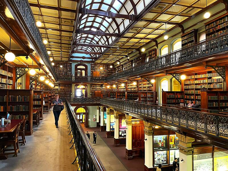
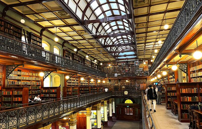
Our last stop for the day was the South Australia State Library. Here's a few pictures of the second floor reading room.
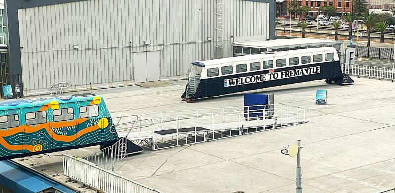
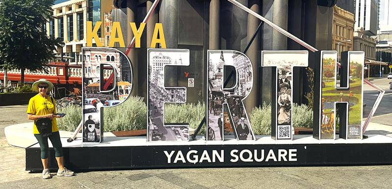
Fremantle & Perth
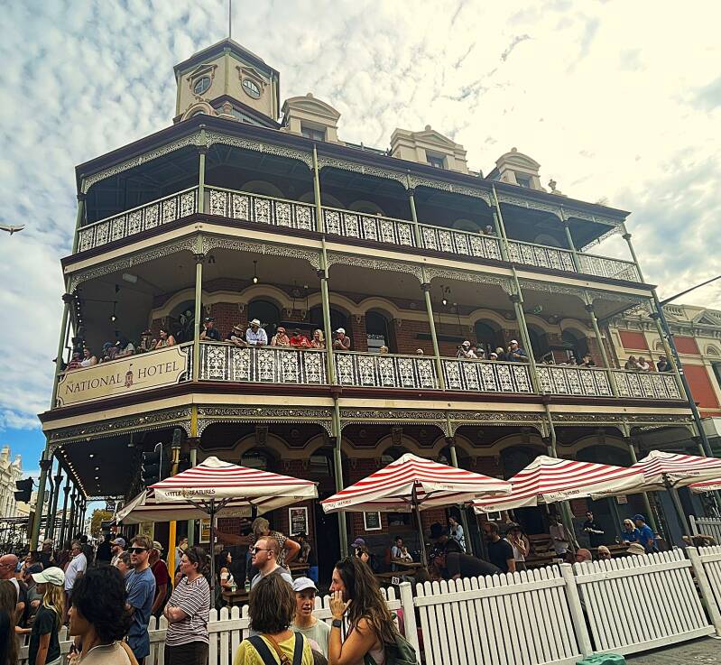
Our ship docked in Fremantle which is a historic port city about 30 minutes southwest of Perth. It was the main port for the Swan River Colony establishment in 1829. The city has one of the best-preserved collections of 19th-century buildings in Australia.
It was our good fortune to stop in Fremantle while their annual street fair was in progress. As we wandered through town we saw many of the street performers including clowns, jugglers and acrobats.
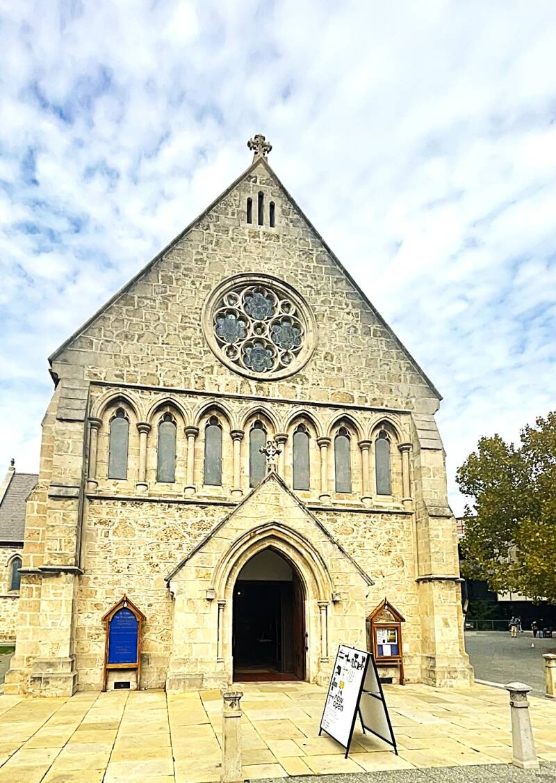
Here's a few the historic sights in Fremantle - Town Hall, St. John Church, Prime Minister John Curtin sign and statue.


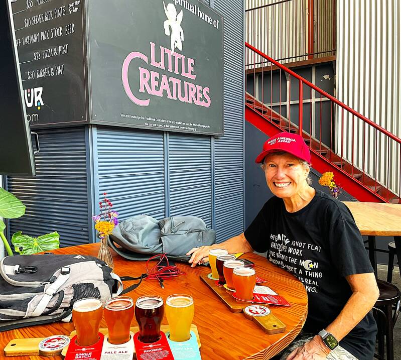
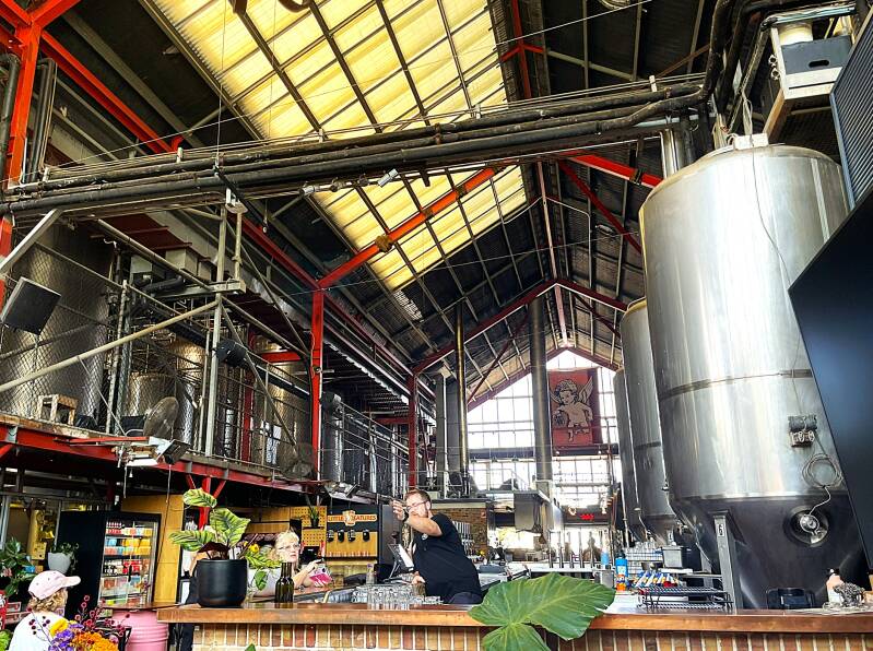
After a hot day of walking the streets of Fremantle, we quenched our thirst at a local and very large craft brewery - Little Creatures. Notice the lettering on Kathie's hat...it was a gift from a fellow traveler from Iceland.
Perth sits on the southwest coast of Australia, bordered by the Indian Ocean to the west and the Swan River winding through the city. It has a population of about 2 million, making it smaller and less dense than Sydney or Melbourne—but also more laid-back.
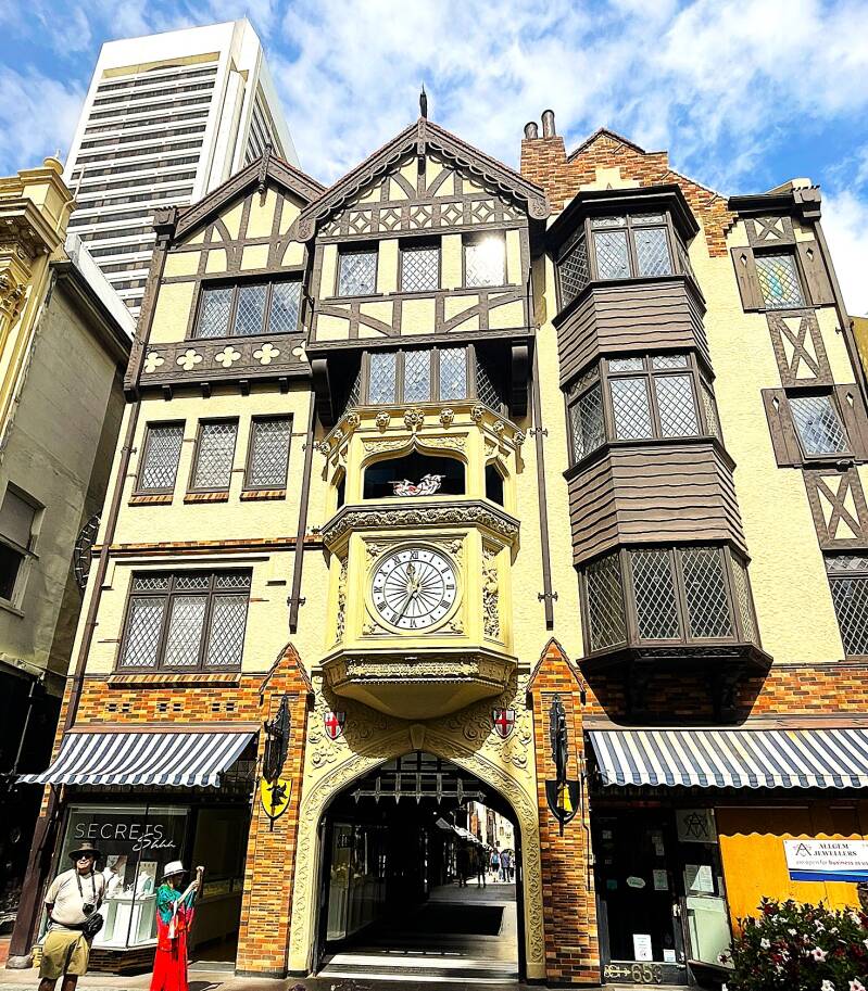
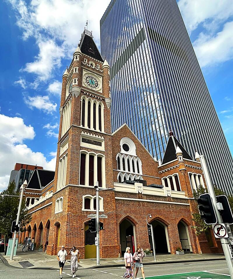
Perth was our last stop in Australia. The train station in Fremantle was directly across the road from where our ship was docked, so a 10-minute walk along the pier and across the street got us on the train to Perth. Although it's a city of 2 million, we were fortunate to visit it on Easter Sunday when the crowds were very limited. From top to bottom, left to right - Justice Center, Governor's House, front and side views of St. Mary's Catholic Cathedral, London Court Shopping arcade exterior and interior, waterfront statue and bell tower, Town Hall, and Native People statue.


That's all for this chapter of the blog. Next stop Is Bali Indonesia.
Create Your Own Website With Webador