2025 - Philippines, Indonesia, Micronesia, Palau
I've added the year identifier because we will be returning to these countries in 2026. Some ports will be the same and other new ports will be added. So let's get going with this next chapter of our trip.
The Philippines sits along the Pacific Ring of Fire, making it prone to earthquakes, volcanic eruptions, and typhoons. There are over 7,600 islands that make up this archipelagic country.
Our trip through the Philippines was plagued by two of those natural disasters - typhoons and an earthquake. You might remember from my last post about Tainan in Taiwan that we had to leave early in order to outrun Typhoon Ragasa. We had one night of significant rocking and rolling, and while the ship moaned and groaned, it held together, and we made it to our first port of Subic Bay. For those of you old enough to remember, Subic Bay was a very significant naval operation before, during, and after World War II. It was decommissioned in 1992 and today is a thriving free trade zone. Because of the effects of the typhoon, we had two steady days of rain in Subic Bay, so our only "adventure" was going shopping at a free trade mall. The only picture I have to offer is our welcome banner at the pier.

Our next stop was the capital city, Manila. We had one good day in Manila before another typhoon chased us out of the port. Central Manila has a population of approximately 2 million, but the greater Manila area is almost 14 million, making it very densely populated. Since this was the first real city we experienced in the Philippines, it was a little jarring. Why? Well, after being in Japan and Taiwan, where everything is clean and organized, that wasn't the case in Manila. Significant traffic and street people trying to hustle you for a ride or a tour, making for an uncomfortable welcome. We sought refuge in the Museum of Natural History, an extraordinary facility about 30 minutes away from the pier. From left to right, top to bottom - Filipino rapid transit :-), statue and plaque from the republic of South Korea thanking the people of the Philippines for their assistance during war, the Museum of Natural History exterior, Blue whale skeleton in museum entrance, Lolong - largest saltwater crocodile ever captured, Lolong explanation sign, Lolong skeleton, fearsome "monkey eating eagle and sign.


After the typhoon chased us out of Manila, our next stop was Boracay Island, which is a major resort island in the Philippines. We anchored a short distance from the island and took a tender ashore where we were greeted by the welcoming committee. Then it was off to the beach for two days where Kathie was able to do a little snorkeling.


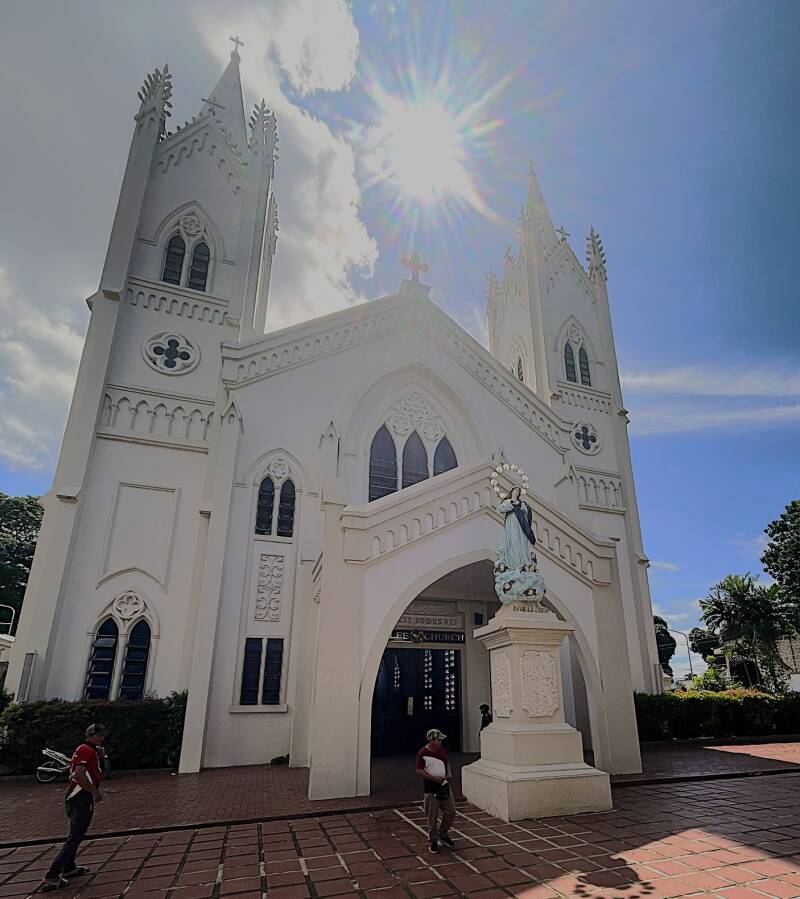
Continuing to navigate through the Philippines, our next stop was Puerto Princesa. Puerto Princesa is the capital city of Palawan Province, located roughly in the center of the long, narrow island of Palawan in the Philippines, with a population of 300,000. As usual, we start with the welcoming band and dancers on the pier. Then, after disembarking and walking out of the port, we had a gauntlet of natives trying to hustle us for a ride or tour. We had some people following us for 2 blocks before they gave up. Regardless, we took a nice stroll through the city and the marina. First, the outside and inside of the cathedral. Then a view of the marina and bay. Then I spied some high-tech Filipino flotation devices.


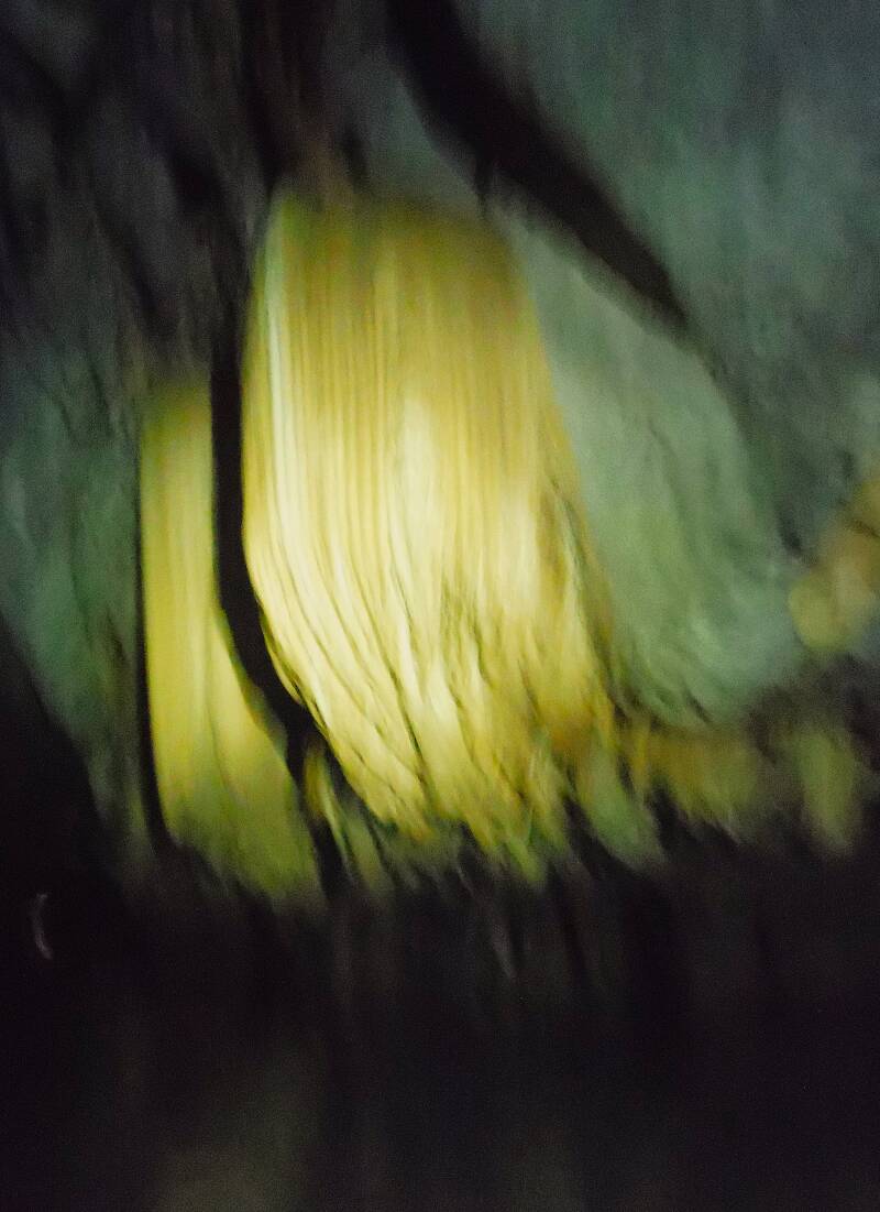
The major attraction for this stop was a two-hour drive to Puerto Princesa Subterranean River National Park (Underground River). This is a UNESCO World Heritage Site and one of the New 7 Wonders of Nature. The underground river runs for about 8 km beneath limestone karst mountains before flowing into the sea. In order to get to the mouth of cave/river, we took a local water taxi to a beach and then a walk to catch a boat tour into the cave to see stunning rock formations, cathedral-like chambers, and a variety of bats and swifts. From top to bottom, left to right - Water taxi and landing beach to start the tour, monitor lizard welcoming us, Kathie donning her protective headgear, here we're getting ready to board our tour boat at the mouth of the river/cave. We were warned multiple times not to look up with our mouth open because a bat, and there were hundreds of them, might decide to let loose with a secretion. Once inside the river/cave, its bitch black, with the only illumination coming from our boat driver's headlamp. Trying to take pictures where he was pointing his headlamp was an exercise in futility, but I'll show you a few just to get an idea of what we were seeing on this 45-minute tour.


Well, the Philippines was going to let us get out without at least one more natural disaster - the Cebu Earthquake 6.9 on the Richter scale. We have a resident-sponsored group on the ship called Global Harmony, and its purpose is to demonstrate that, as we travel the world, we want our humanitarian efforts to be recognized as being good global citizens. With that said, the majority of the time we spent in Cebu was dedicated to working with local relief teams to package goods and supplies for those Filipinos directly affected by the earthquake. Even though many Cebu residents were busy helping with relief efforts, they still had time to welcome us at the pier. Then, a picture of the damage from the earthquake. Here's a picture of the Global Harmony team before heading off to the relief facility. Finally, here they are the relief facility.


Indonesia is a vast and diverse country in Southeast Asia, made up of over 17,000 islands, stretching more than 5,000 kilometers (3,100 miles) from west to east between the Indian and Pacific Oceans. It’s the world’s largest archipelago and the fourth most populous country, with more than 275 million people
Our first stop, a one-day visit, was to the active volcanic island of Ternate. For Kathie and I, it was another very interesting diversion from our previous ports of call. Basically, the whole island is the volcano and almost all of the residents live along the shore, and I swear every one of them has at least two motorbikes :-). Indonesia is almost 80% Muslim, and that became obvious immediately as their prayers at noon were broadcast through loudspeakers so they could be heard in every part of town. The other noticeable difference was the amount of trash that could be seen on the streets and in the water. Unfortunately, it goes with being a very poor country. Lastly, and a first for us, it is the home to the Sultanate of Ternate, a powerful Islamic kingdom that began in the 13th century and dominated regional politics for centuries. From top to bottom, left to right - Gamalama volcano, Ternate welcome sign, Ternate boardwalk, Minaret and mosque, the current Sultan, Sultan's palace. They had a museum on the palace grounds, and we never miss an opportunity to go to the museum. From left to right - Chronological list of Sultan's starting with No. 1 in 1257, Sultan's crest of armor, Sultan's coronation carriage.


We had multiple additional stops in Indonesia, but before those, we stopped at the Island of Yap, which is part of the Federated States of Micronesia, and then the Island nation of Palau. If you're trying to find Yap on the map, find Guam, then go 500 miles southwest—you'll find Yap. Our two-day stay in Yap started on a tentative note because they weren't sure their pier was big enough to accommodate our 600-foot-long boat. As it turned out, the answer was just barely. For the most part, Yap is known for two attractions - snorkeling/diving with the manta rays and ancient stone money. We opted to skip the manta rays and instead went in search of the ancient stone money. Our first stop on our search for stone money was their "Living History Museum". Outside of plants that were alive, I didn't see any other living history, but I did see some ancient stone money and some traditional thatch houses. Our destination was the "famous" stone money bank. Along the route, we found a "street of stone money and then finally the bank. These massive carved limestone disks, some up to 12 feet in diameter, were historically used as currency for major transactions like marriages, land, or alliances. The value wasn’t based on size alone, but on history and ownership.


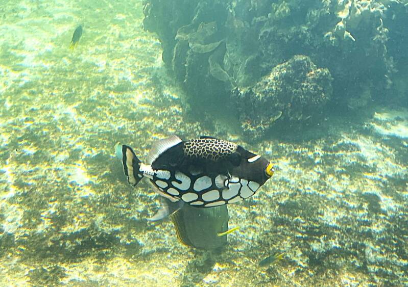
Our next stop was three days at anchorage on the Island nation of Palau, and its capital city Koror. Besides being a notable location for fighting in World War II, Palau's major claim to fame is its biodiversity and crystal clear water. Each day we took our ship's tenders into the Palau Pacific Resort Pier. For a fee of $45 pp per day we had access to their beach, pool and water activities. Kathie and I did snorkeling the first day, Kathie also did it the second day, and the third day we went into Koror to explore their museum and aquarium. Here's a few of the fish and coral that we saw while snorkeling at the Palau Pacific resort. While the museum was not large it was quite interesting. Unfortunately they did allow picture taking for most of the exhibit. Here's the entrance to museum and the geology of Palau.


While we enjoyed the fish and coral while snorkeling, the aquarium in Koror took it to another level. From left to right - two views of a giant clam and smaller clams for perspective, starfish in the "petting zoo", Nautilus in the aquarium, and no port would be complete without a refreshing can of their national beer "Red Rooster".


Our next port of call was Bitung, a coastal city on the north-eastern edge of the island of Sulawesi in Indonesia with a population of approximately 232,000. Well, it was another port that wanted to welcome us with their sign and native dancing troop. Some of our residents took the opportunity to "act the fools" by participating in a mock battle.


Our primary destination for this stop was the port of Manado, on the western side of the island. We took a two-hour taxi ride ($18) across the island to stay at a nice new hotel (Swiss Belhotel - $39 a night). In the rain that evening, we took a walking tour through Manado's Chinatown district and then stopped for a typical Indonesian dinner ($4 for both of us with drinks). Here's a few Chinese temples and dinner.


The purpose of our trip to Manado was to go snorkeling the next day. After a very twisty road trip, we arrived at a rather decrepit street with a small marina. While it was home to a couple of large Indonesian Coast Guard cutters, we boarded a little homemade wooden boat for a trip over to Lihaga Island for our snorkeling adventure. Where we saw hundreds of fish in Palau, we saw thousands of fish off the beach of Lihaga Island. I won't bore you with more tropical fish pictures, BUT if you really want more, just reach out to Kathie, she's building a database of them :-). Here we are heading to the marina, here's the coast guard cutters, and here's Lihaga Island in the distance - look for the white sand beach.


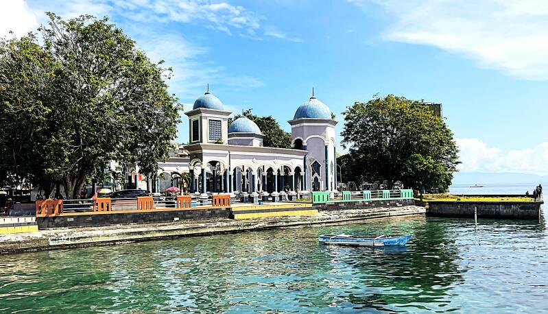
Our last stop in Indonesia for 2025 was the port of Sorong. Its main claim to fame is the nearby (1 hour by speedboat) Raja Ampat Islands. They're considered one of the top marine biodiversity hotspots in the world and a definite attraction for Kathie to go snorkeling. Yes, just Kathie because by now I'm getting a bit waterlogged and tired. There wasn't much to do around the port, so the best I can do for you is one picture of the Sorong cruise terminal.

Create Your Own Website With Webador